"Short" walk weekend this weekend, and glorious weather.
The penny has finally dropped that it may not be 13degrees, overcast, with a light drizzle on 22nd May. As such I need some warm weather kit to see me through the 29miler. A trip to Go Outdoors, and I have a Tilley Hat, a North Face walking shirt, and a pair of Saucony Progrid Xodus 2 trail running shoes. Cool feet and sun protection.
I watched the Malaysian Grand Prix in the morning, and after picking up the small dog it was well after lunch before I got to the Derwent Valley. It was packed. After queuing for half an hour I managed to get a spot in the Fairholmes carpark at the visitor centre.
At £2.5 for 2 hrs or £4 for all day, I was forced to head down to the visitor centre for an ice-cream to get change...
I've done the circuit of Ladybower a few times. I ran it many years ago, anticlockwise. I walked it last autumn anticlockwise. My strongest memory of this is the long road section at the end, when my feet were tired and my spirits low. So I did it clockwise this time.
It's definitely easier clockwise.
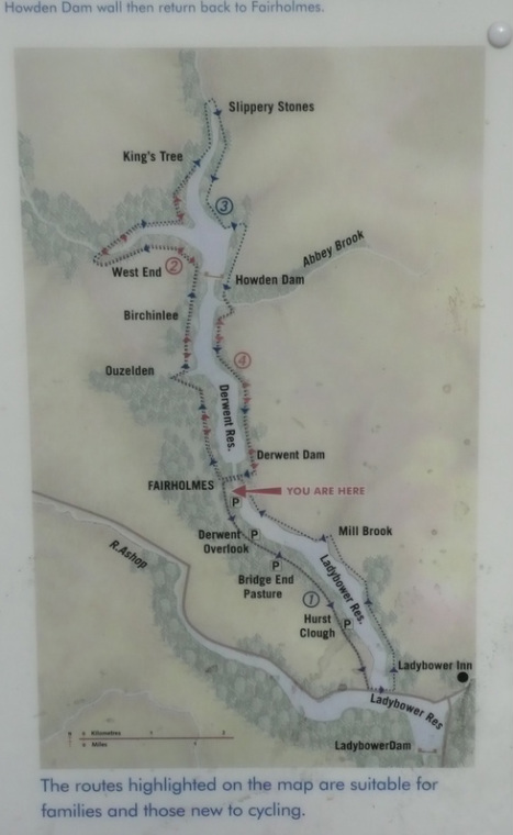
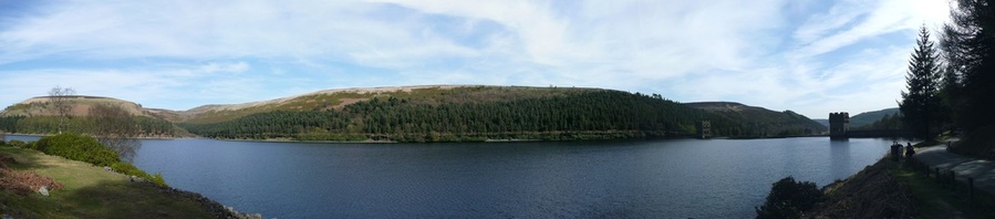
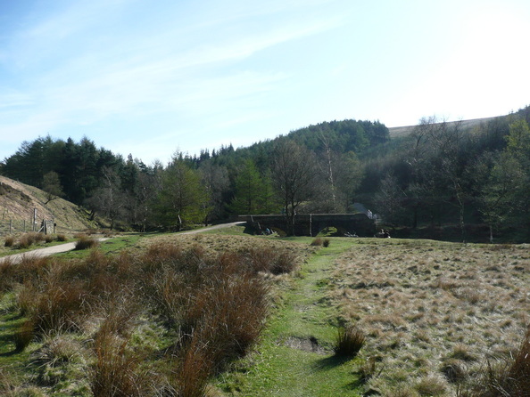
The route is just a circuit of the Y-shaped lake. There are a couple of dams on the route.
The penny has finally dropped that it may not be 13degrees, overcast, with a light drizzle on 22nd May. As such I need some warm weather kit to see me through the 29miler. A trip to Go Outdoors, and I have a Tilley Hat, a North Face walking shirt, and a pair of Saucony Progrid Xodus 2 trail running shoes. Cool feet and sun protection.
I watched the Malaysian Grand Prix in the morning, and after picking up the small dog it was well after lunch before I got to the Derwent Valley. It was packed. After queuing for half an hour I managed to get a spot in the Fairholmes carpark at the visitor centre.
At £2.5 for 2 hrs or £4 for all day, I was forced to head down to the visitor centre for an ice-cream to get change...
I've done the circuit of Ladybower a few times. I ran it many years ago, anticlockwise. I walked it last autumn anticlockwise. My strongest memory of this is the long road section at the end, when my feet were tired and my spirits low. So I did it clockwise this time.
It's definitely easier clockwise.
The route is just a circuit of the Y-shaped lake. There are a couple of dams on the route.
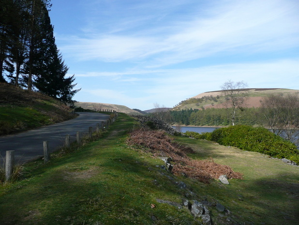
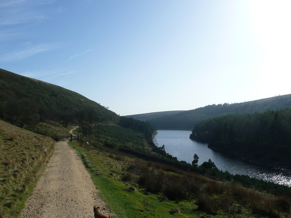
The road runs alongside the lake. There is a service bus which runs up and down, he passed me a number of times.
There were a phenomenal number of cyclists out. It was like Beijing. One family seemed disheartened that they set off away from me, stopped a little further on to get their breath back, and I would pass them as they were parked up.
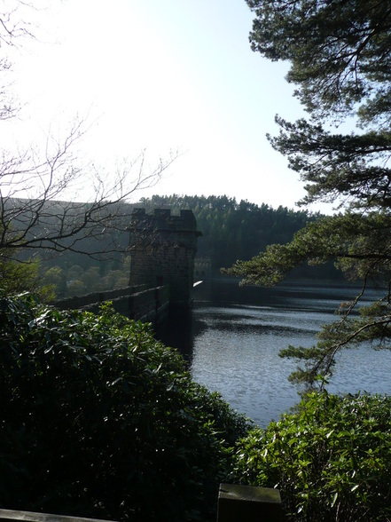
They were planning to cross the second dam and return down the other side. Unfortunately this is not possible, as the dams are gated and closed off for the most part - you can't use them as bridges. They turned back instead.
There were a phenomenal number of cyclists out. It was like Beijing. One family seemed disheartened that they set off away from me, stopped a little further on to get their breath back, and I would pass them as they were parked up.
They were planning to cross the second dam and return down the other side. Unfortunately this is not possible, as the dams are gated and closed off for the most part - you can't use them as bridges. They turned back instead.
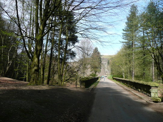
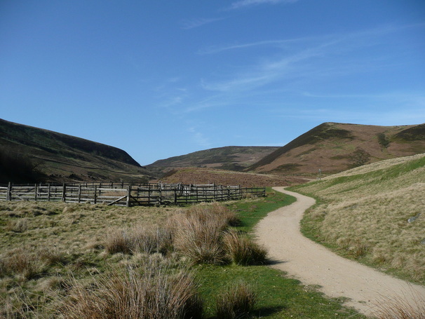
Eventually I reached the turning circle at the end of the road. Things got a lot quieter from here on.
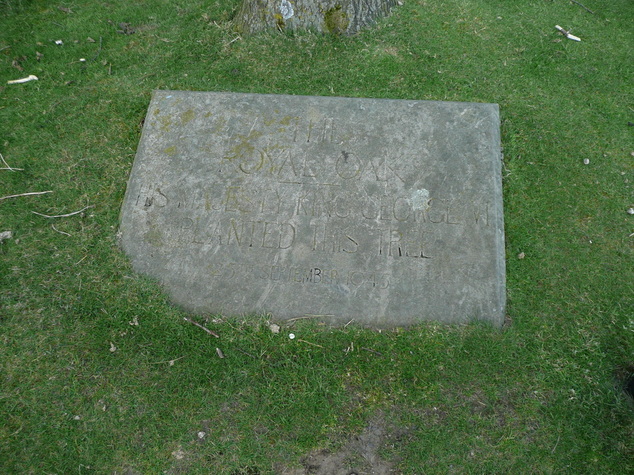
There is a tree in the centre of the turning circle with a plaque.
It makes reference to "The Royal Oak" and George VI planting the tree in 1945, but it's difficult to see in the picture.
I'm guessing there is probably a Dambusters link.
There is a tree in the centre of the turning circle with a plaque.
It makes reference to "The Royal Oak" and George VI planting the tree in 1945, but it's difficult to see in the picture.
I'm guessing there is probably a Dambusters link.
There was a river coming in from the left just after the road ended, so I was able to cool the dog off and get some water into her.
There are plenty of little streams coming down off the hillside, and she was drinking from these, but it was so hot I was keen to avoid her overheating.
There are plenty of little streams coming down off the hillside, and she was drinking from these, but it was so hot I was keen to avoid her overheating.
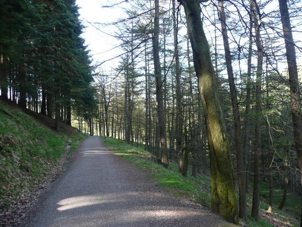
It was good to get off the road, and to have a reduction in the number of cyclists.
A good path ran up to the very end of the lake, and "Slippery Stones". A path continued from here up onto the moors, but after watering the dog again in the river, we turned across and began to follow the far shore of the lake back down the valley.
A good path ran up to the very end of the lake, and "Slippery Stones". A path continued from here up onto the moors, but after watering the dog again in the river, we turned across and began to follow the far shore of the lake back down the valley.
There was no shade at all on this section, and despite it only being the beginning of April, the sun beat down relentlessly. Despite her dip in the river, and regular drinks from streams crossing our path, small dog lost her appetite for walking uphill.
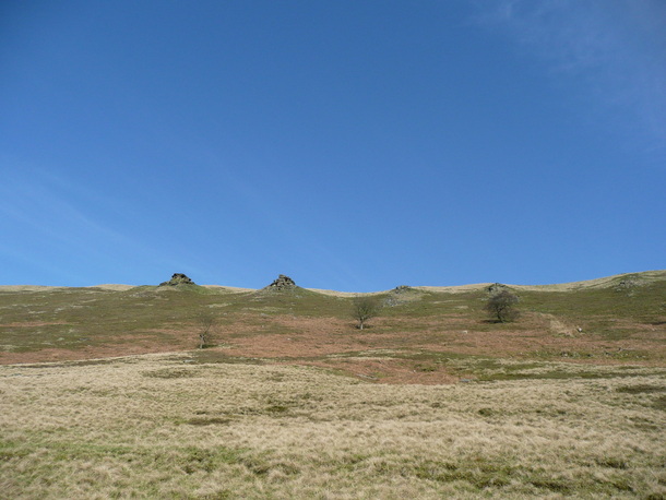
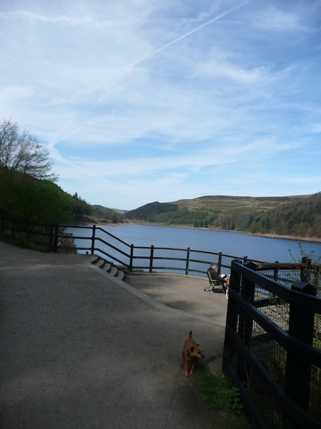
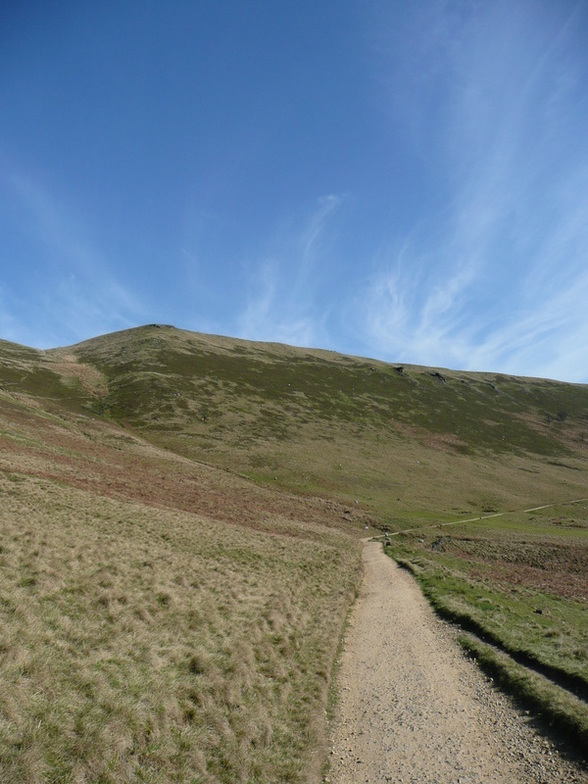
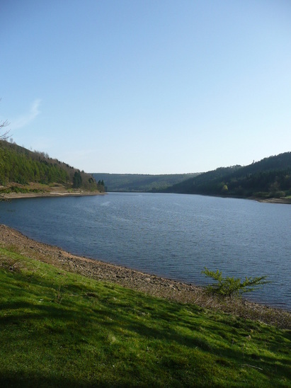
The valley is impressively steep sided - this is a view up to the crags overhead.
I've never walked along the top, but I fancy giving it a go some day
I've never walked along the top, but I fancy giving it a go some day
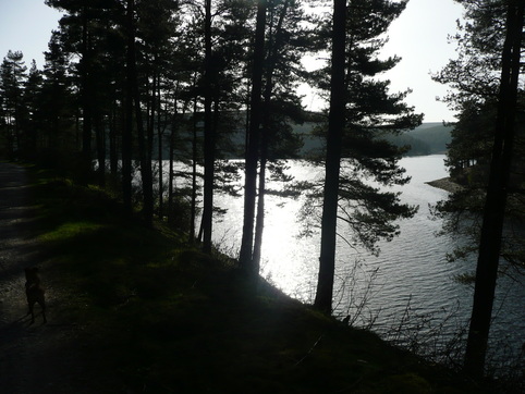
Eventually we dropped back in to the woods along the edge of the lake, and the dog perked up.
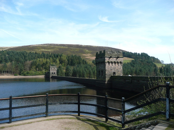
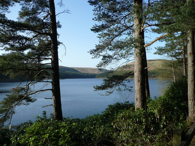
Back to the "second" Dam
Looking back up the lake
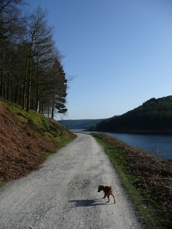
We left the trees again on the final stretch back down to the "first" dam and Fairholmes carpark.
The dog spotted a sunbathing lizard on the path. I managed to lock the lead in time to save it, but it ran away into the dead bracken before I could get my camera out.
The dog spotted a sunbathing lizard on the path. I managed to lock the lead in time to save it, but it ran away into the dead bracken before I could get my camera out.
It was around 6pm by the time we got back to the car, and the carpark had cleared. The dog slept all the way home.
I had hoped for a faster time than 3hrs30, but given the weather (and how tired the pooch was), I think that was OK.
We weren't exactly pushing it.
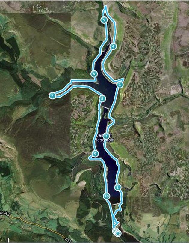
This GPS trace is from last time I went around - I went round in the opposite direction, but it I had covered over a mile before the GPS locked in, so the distance is misleading.
I had hoped for a faster time than 3hrs30, but given the weather (and how tired the pooch was), I think that was OK.
We weren't exactly pushing it.
This GPS trace is from last time I went around - I went round in the opposite direction, but it I had covered over a mile before the GPS locked in, so the distance is misleading.
 RSS Feed