Twelve months of anticipation and over 400 miles of training walks saw me awake at 6am in the Glen Nevis SYHA having had little sleep, and still suffering from the effects of a 72hr "24hr" viral stomach upset. I had hardly eaten or slept since Friday, and here I was on the Sunday morning, wishing I had baled out when I had the chance.
I had returned home from work on the Thursday to find my family all ill. My heart sank with the crashing inevitability, and sure enough I just about made it back into the house after a Friday spent on the motorway visiting a customer site, when I joined them.
The planned 8am start was pushed back to late morning as I dosed up on immodium and anti-nausea meds from the local chemist, but I figured that as the others had perked up after a day or so, I would be OK. I just needed to get through the 370mile journey up to Fort William, and stay hydrated.
Only I didn't really improve. I perked up a bit at Glen Coe, but I still couldn't sleep or keep any food down.
We grabbed a few supplies, and half a burger, in Fort William, and headed up to Glen Nevis for the night. Which takes us back to where we came in. I knew I was in no state to tackle our planned route via the CMD arete. There was a forecast for high winds coming in late afternoon, so a delay could have potentially been dangerous. I was a couple of hours later out of bed than planned, weak, and already dehydrated. I wasn't even sure I could tackle the tourist route, but I was sure as hell going to try.
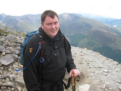
After no less than four false starts, returning back to the room for bits of forgotten kit, and forgetting new bits, we were ready to set off. Dan had the patience of a saint, and I wasn't about to get any less annoying.
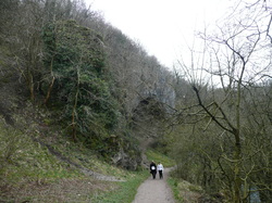
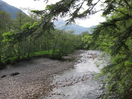
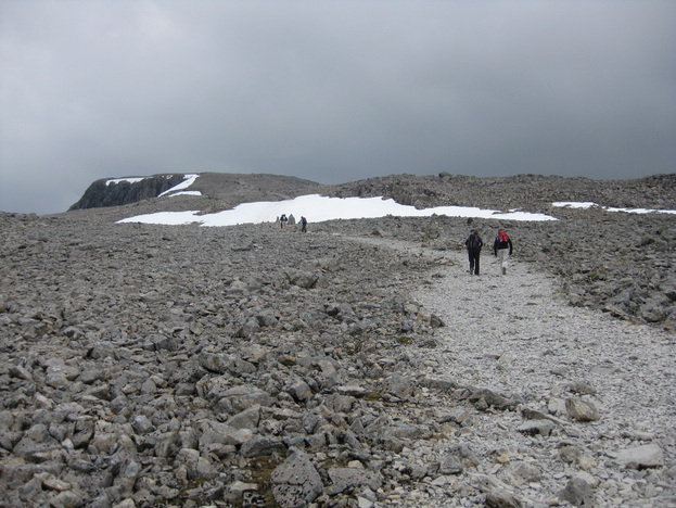
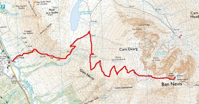
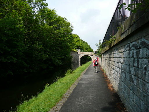
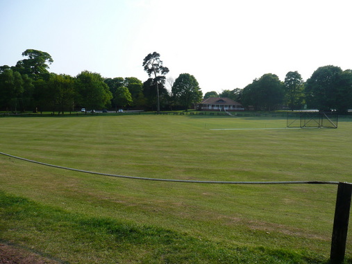
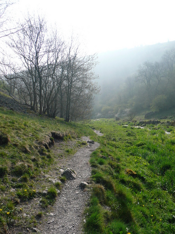
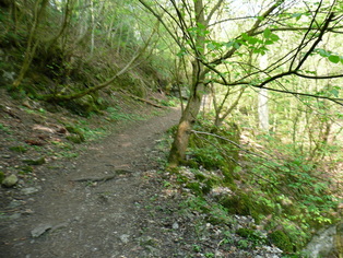
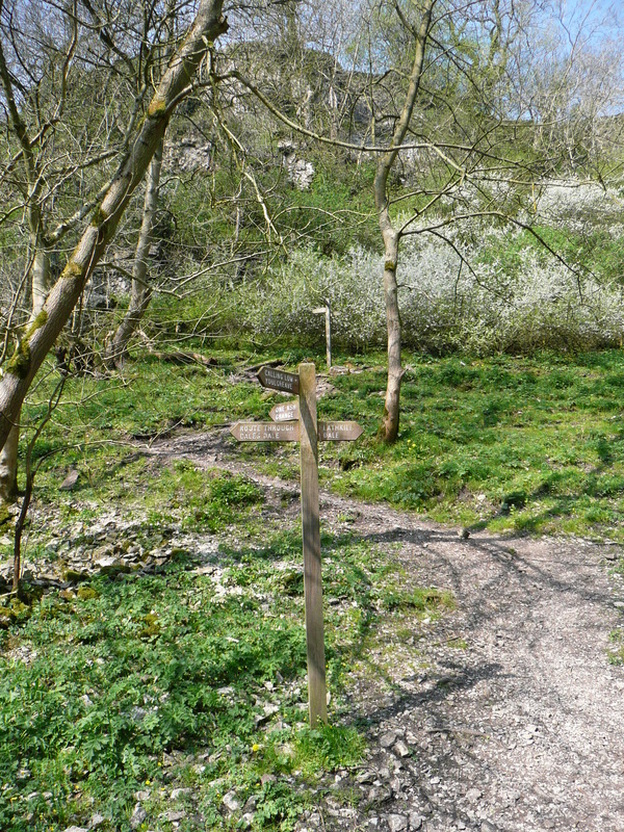
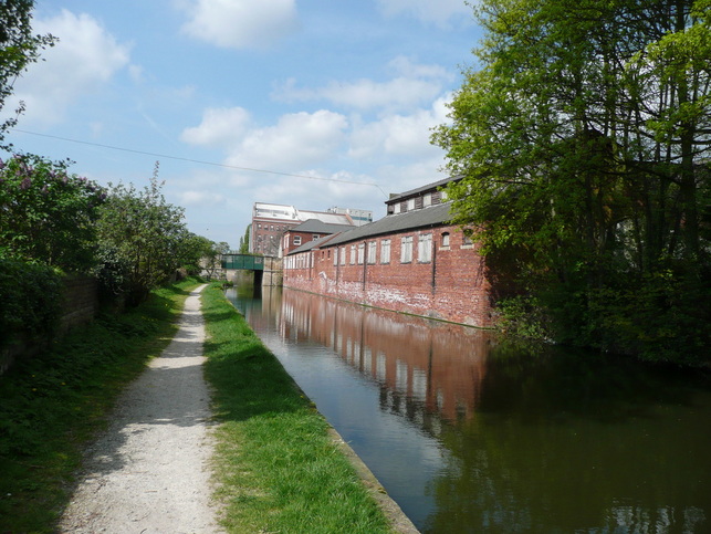
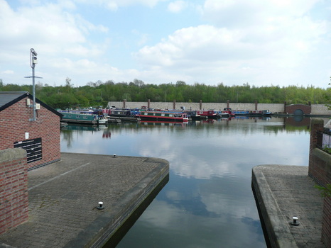
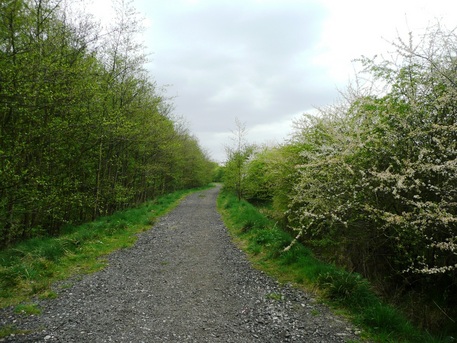
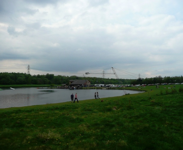
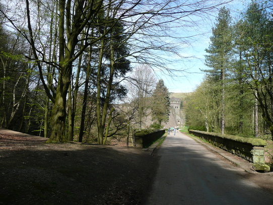
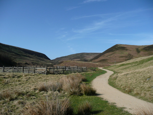
The "SYHA" path started directly opposite the Youth Hostel. We had planned to walk down and pick up the tourist path from the bottom, but as we were already on the SYHA, it seemed rude not to. It was a pretty steep start, similar to when I walked up Kinder Scout over Ringing Roger. I had eaten a Morrisons Pain Au Chocolate for breakfast - more like a chocolate sausage roll, if i'm honest - and it wasn't really powering me up the hillside. I knew I was already in trouble, and it was going to be a first gear grind all day.
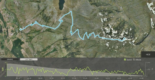
I was using a wrist watch GPS and altimeter to track our progress. I was going hopelessly slowly, but I was going.
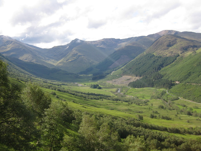
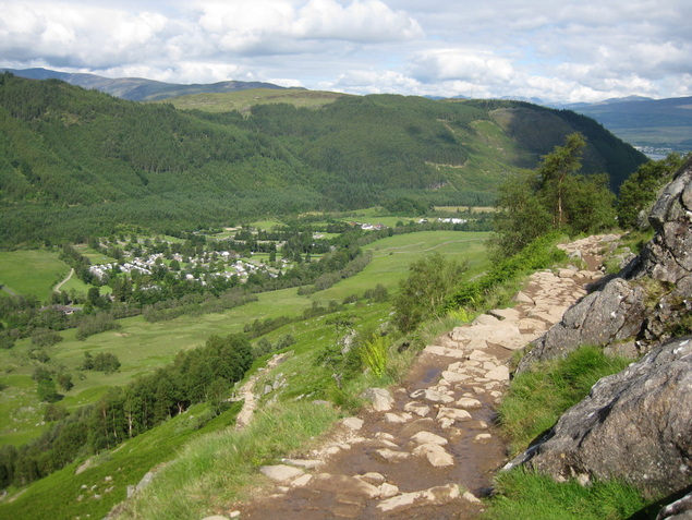
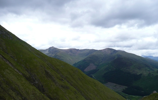
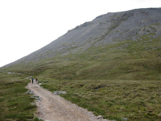
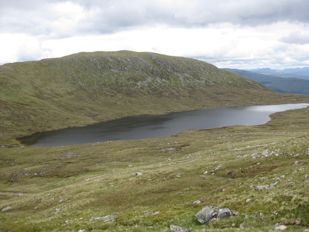
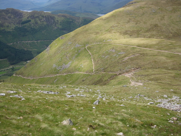
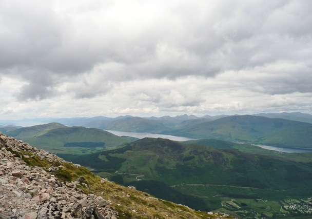
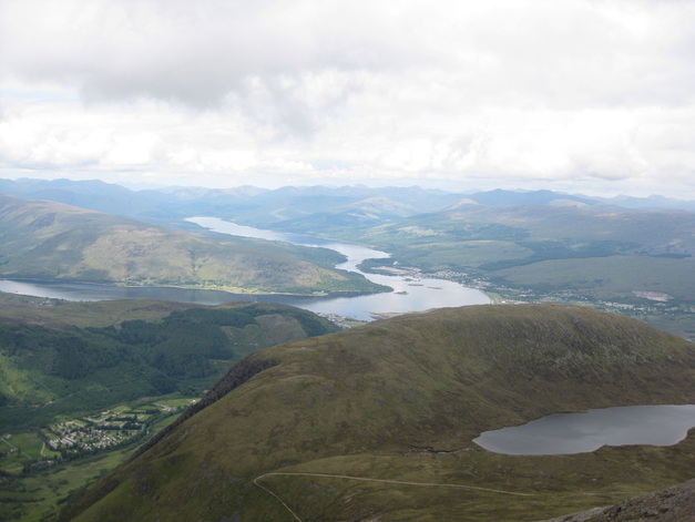
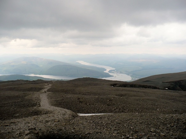
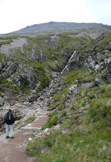
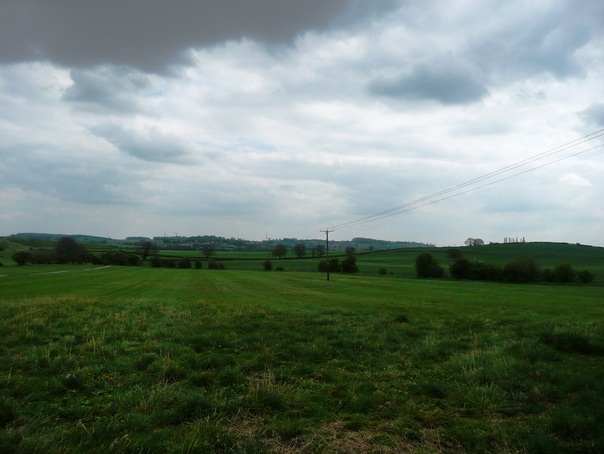
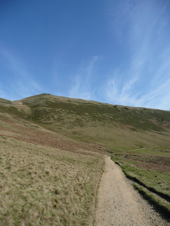
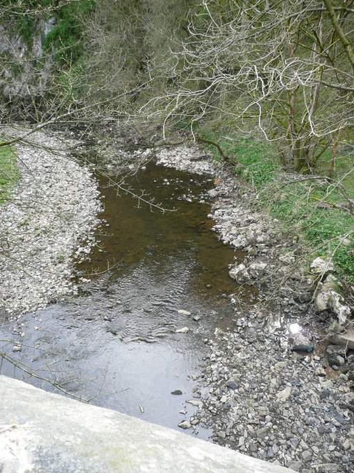
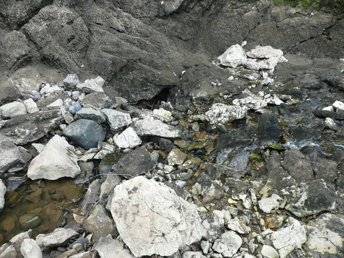
The steep start had cost me, and I motivated myself by setting a goal of climbing another 250ft, having a sip of drink and a 30second break, and seeing how I was. I was unchanged at each checkpoint, and I had got that far, so I knew I could do the next 250ft. And so it went on. This technique took me to the Halfway Lochan at the shoulder of the mountain, Lochan Meall an t-Suide the col between Carn Dearg and Meall an t-Suide. At 560m, it's a fair way short of being "half way". But it represented progress. We climbed on, 250ft at a time. The waterfall where the stream crosses the path at around the 2,250ft mark seems to be a turnaround point for a lot of people. After a respite in the gradient of the path coming from the Lochan, you can see the zig-zags up the rocky section ahead. Some people seemed put off by crossing 1" of water. After slogging up to the true half way point, there was no way I was giving up here, and set my next target as the 3000ft mark. Munro height. If you can do two thirds of something, you can do the whole thing, right?
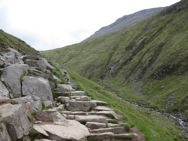
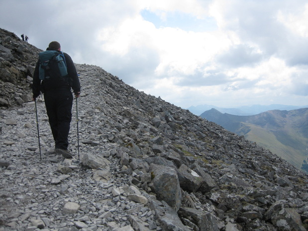
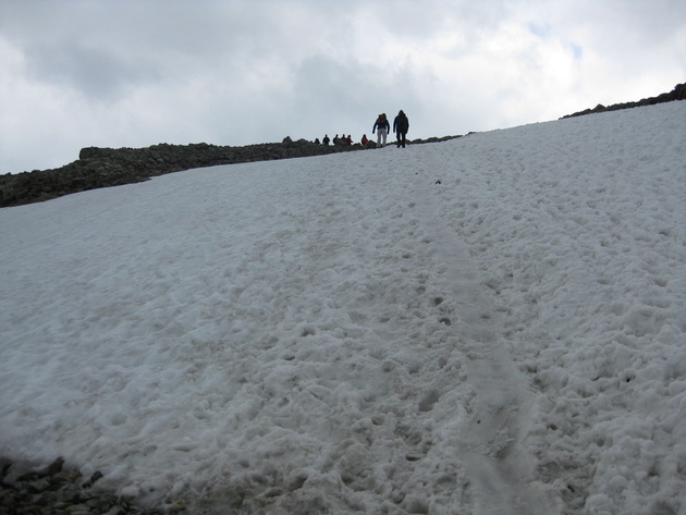
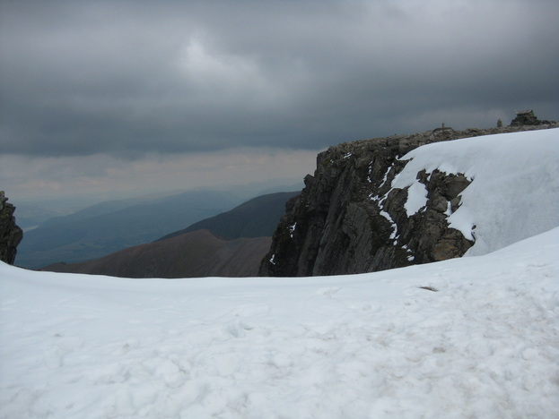
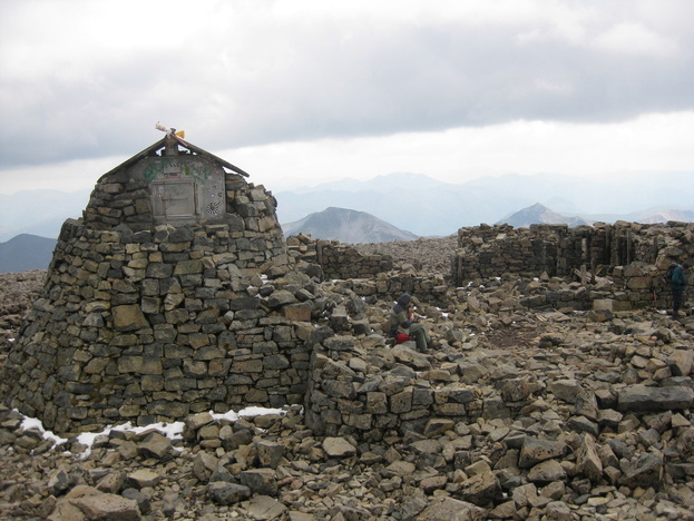
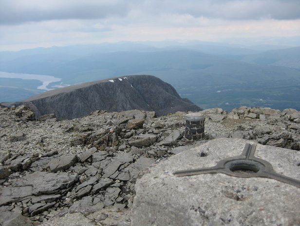
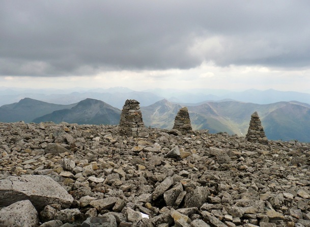
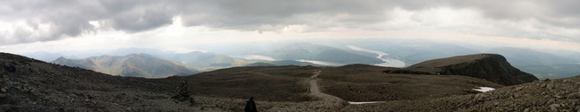
Right. I perked up at the summit plateau. The cairns were marking the "safe" path, which doesn't follow the same route as the made path, but is easily followed as a bearing in white-out conditions.
The snow patch was hard. I was exhausted, and it was a lot steeper than it looks above.
It was fairly fresh snow, as well. Every second step I took, I slid back one. The snow patch really cost me. I could almost touch the summit, but I hadn't the strength to go on.
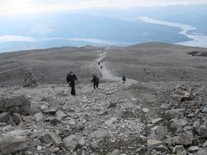
After a serious word with myself, I pushed on up to the trig point. There are ruined buildings on the summit - an old weather station, and some low walls. But no toilets. I'd held out for over 5 hours, and needed to get down off the hill as quickly as possible! We didn't hang around too long, and set off down the mountain as quickly as we were able. After another bad night courtesy of a load of French students, who had invaded the Youth Hostel, and were partying in the corridor outside my room, I actually felt OK the next day.
A Full English in Morrisons' cafe, and we hit the road back. The 2011 Caledonian Challenge cycle race delayed things a little through torrential rain in Glencoe, but otherwise it was a fairly smooth trip back.
It took me until the next weekend to properly get over things - i'd lost half a stone and was very dehydrated.
Such a shame the way things panned out. I'd defintiely go back. The Tourist Route gets a hard time, but I really enjoyed it - the scenery was stunning.
Next up... Scafell Pike in September? That would nicely clear off the "National Three Peaks" in 12months.
"D-Day" saw me awake in a hotel room in Leeds, with a headache. The suggested evening before prep for an endurance event is carb loading on brown pasta, lots of hydration, and a decent sleep. I went for steak and chips, half a bottle of red, an uncomfortable bed, and lots of noise from the street.
Anyway, I got ready in a state of some anxiety, checked out without breakfast, and headed on down to the Royal Armouries via the Tesco Metro, where I bought some pastries, a Red Bull (no coffee), and a "Lucozade Shot" - an impulse purchase, and something I hadn't tried before.
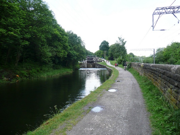
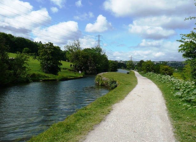
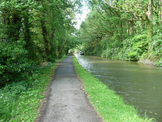
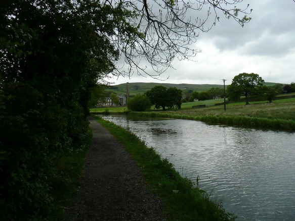
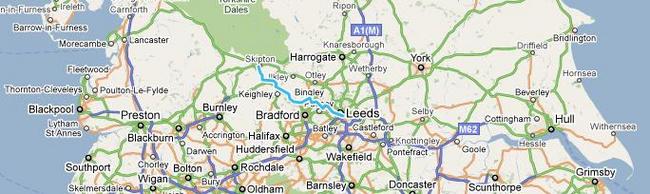
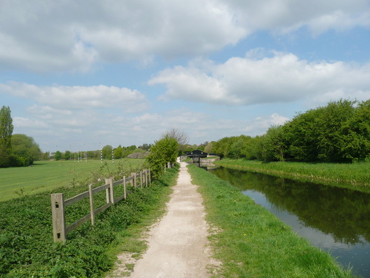
After parking in the Multi-Story at the Royal Armouries, we found the start line in a state of disarray. It was around 08:40 and BHF staff were unloading bottles of water. They gave me a T-shirt, and said I could start if I wanted. The route around Leeds was signposted to "Granary Wharf", and after that it was just towpath to Skipton. Quite a few walkers seemed to have taken a short cut direct to Granary Wharf instead of following the more circuitous BHF route, which narked me a bit.
Anyway, once on the towpath the showers started, some of them very heavy. This sent folk scurrying under trees and looking for waterproof jackets. I'd got a Paramo windproof which i'd sprayed with Nikwax. It was breathable enough to wear all day, but the water just beaded off, so I just put my hood up and pressed on. The pace was fast. As fast as any of my shorter training walks. I was having to resist the urge to race people, and try and force myself to keep my own pace.
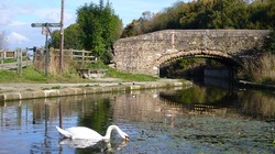
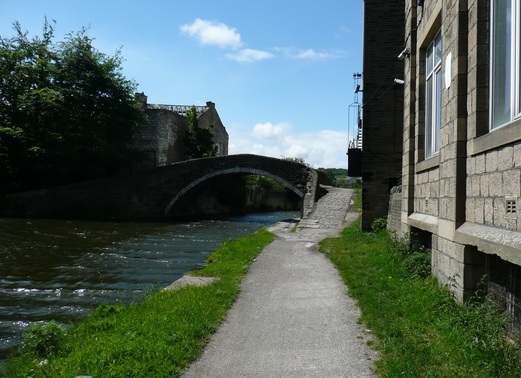
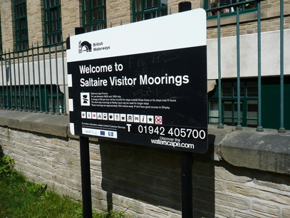
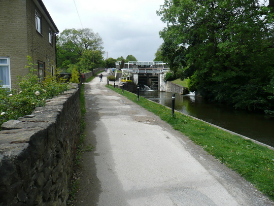
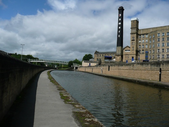
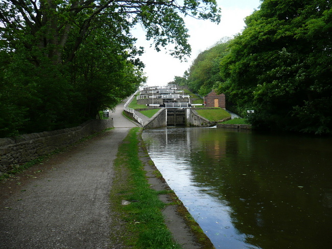
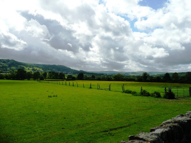
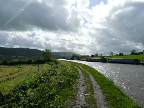
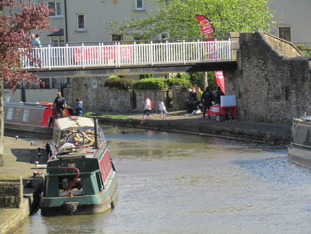
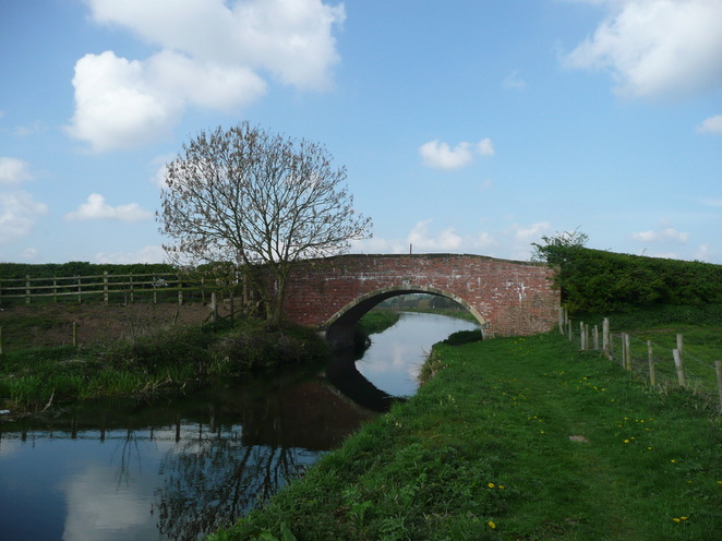
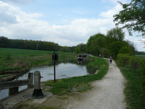
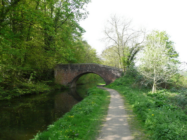
I was unsure how to hit a 9hr pace, and decided to just walk at what felt to be a natural fast pace, without going crazy. But after about 8 miles, I could feel discomfort in my left heel and under the ball of my right foot. This didn't bode well. The only toilets I saw all day were at a checkpoint around the 8mile mark. These were only open by BHF having a key. This would pose a problem to anyone planning to repeat the walk, although there were pubs along the route. It's difficult to photograph wind, but in the bridge pic below you can see the "white horses" on the waves being whipped up on the canal. The wind got stronger during the day, and in some of the more exposed sections I was struggling to push against it. At Saltaire, I began to encounter the front runners walking in the opposite direction. I crossed over with my friends who had started from Skipton at an indicated 15.5 miles. The Damart factory!
You can see the rain hitting the canal in this shot of the 5 locks.
At the checkpoint I met my wife, changed my socks, and refilled my hydration system with another 2litres of isotonic, taking a bottle of water as a reserve.
My feet were already badly blistered, but the pain was tolerable, so I pushed on.
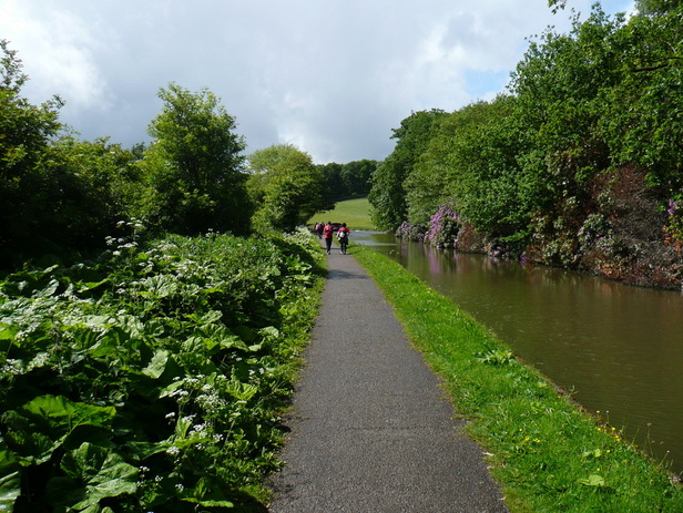
Refreshed from my short break, I was doing OK. Snacking dextrose tablets, I drank a bottle of Lucozade Shot which I had bought in the Tesco Metro before the start. I had never had it before and it was foul. I could feel it burning my throat, and my stomach rumbled violently. I had a noticeable increase in energy, so put some dance music on my headphones, and put in a good pace. I didn't know how sustainable it was, but decided to go with it. I probably passed about 15 people at my fast pace (sub-17min miles). I chatted with them on the way past, and most of them were struggling with blisters, fatigue, or both.
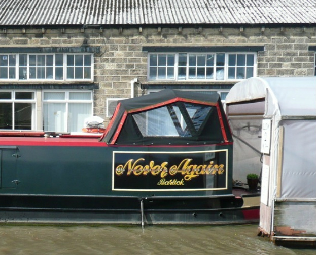
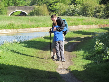
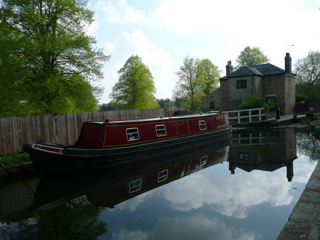
My walking poles were a real point of interest - this surprised me. I bought them around the turn of the century when they were trendy in hillwalking circles, but they've mostly sat in the back of a cupboard until I started doing the longer walks. I've found them to be a fantastic help. I was amused by the name of this Narrowboat. Trouble.
Just after texting through to say I was approaching Skipton, severe stomach cramps kicked in. These got worse, and I had to give up on my hopes of catching the two guys in the walking gear, and slowed right down.
Eventually I was managing no more than 10 steps before having to stop and try to regain my composure. I was unsure if I was going to finish. I stopped on my poles, and began to panic, when around the corner came a flash of blue.
It was my welcoming committee come to find me.
We walked together to the finish line, finishing at 18:00, where I received my medal, and the key to the toilet!
The BHF rep at the finish commented upon how few folk had finished on time, and that they were planning to hold the finish line and checkpoints open quite a bit later.
I was still struggling badly with my stomach until I remembered I had some pills in the rucksack. I brightened up after that, and after resting for about half an hour with my family, and lots of photographs, I drove home.
I had to stop at the services to loosen my shoes as my feet swelled up massively, but otherwise didn't feel too bad,
I felt like I had 'flu for a couple of days afterwards. My blisters were pretty bad, but unbroken, so I was able to walk normally after a few days of hobbling. I'm still tired a week later!
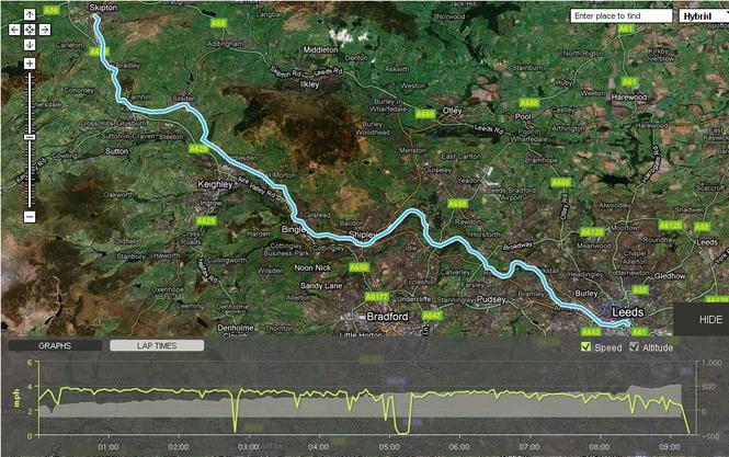
Epic walk. The hard paths and strong headwinds made this much harder than my training walks. The pale blue line is the route off the walk.
So that's the Ultramarathon over with. I've already had a planning meeting for Nevis on 13th June. Time to start training on some less flat routes. At least for Nevis I can do it in my own time.
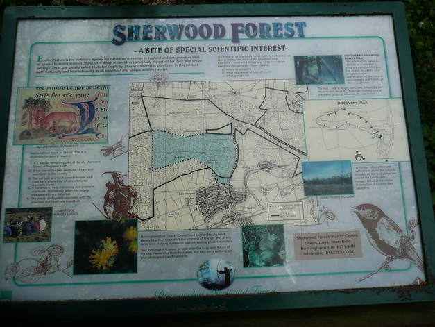
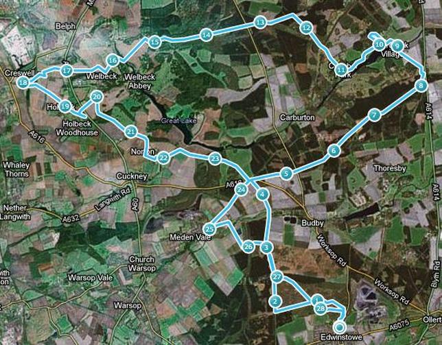
Royal Wedding bank holiday weekend, and I was due to do the last of my big training walks. I was bang out of walks ideas, and was "on call" from work. A bit of a calendar reshuffle, some inspiration from my wife, the rejection of the idea of doing the first two legs of the Pennine Way in one day, and I was in the car, heading towards Edwinstowe. As a youngster I visited Sherwood Forest many times, including a night-time navigational exercise in the woods. But I hadn't been back for years (despite visiting Center Parcs nearby).
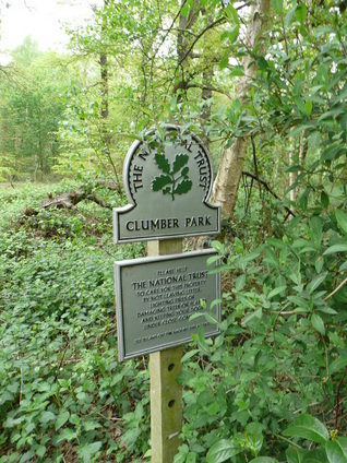
The Robin Hood Way long distance path has an appealling looking loop at this end of its 107mile length, and by cutting off a short section, it looked to me as if I could work out a marathon-length loop around Sherwood, Clumber Park, and Creswell Crags.
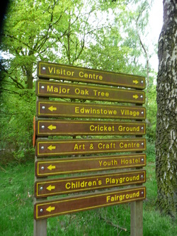
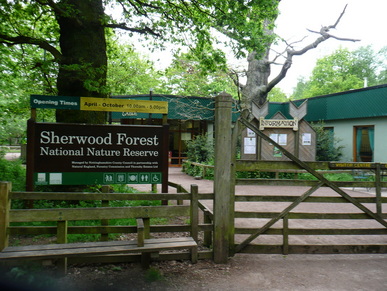
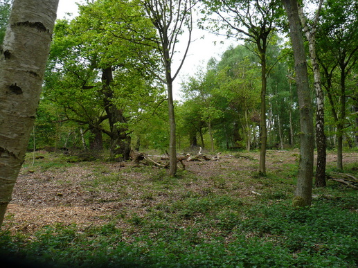
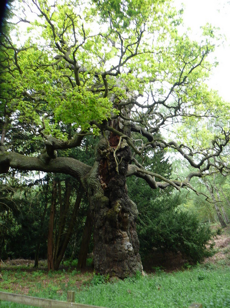
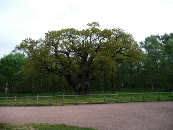
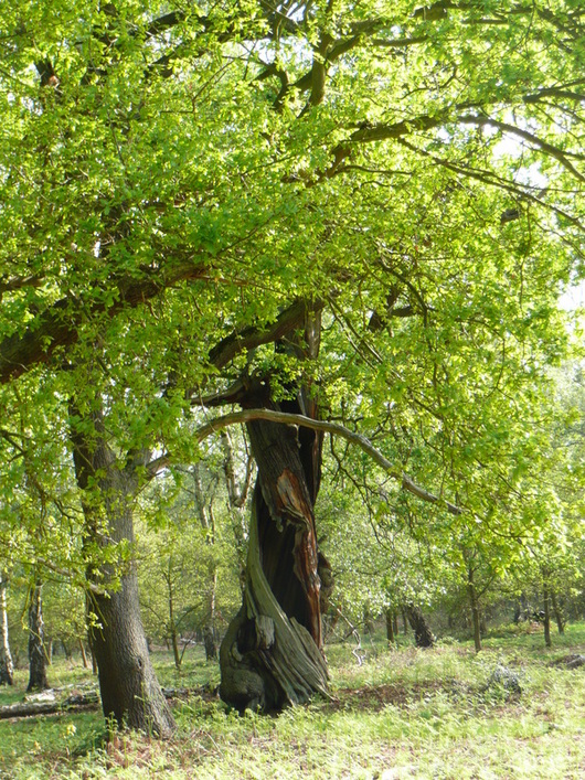
Armed with an OS Explorer map, I parked up by Edwinstowe Cricket Club, and headed towards the Sherwood Forest Visitor Centre. I was a bit early for the visitor centre to be open, so made my way towards the Major Oak, rumoured hiding place of medieval insurgent Robin Hood. Big props to the Oak.  Routefinding got... interesting.
I couldn't find any Robin Hood Way markers, just markers for the Dukeries Multi-User Trail. This was not marked on my map.
I hate walking holding a map and compass, especially when in an area frequented by locals walking dogs.
Eventually I picked up what I thought was the correct path, and checking bearings and junctions against the map, I was able to check where I was.
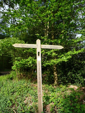
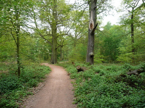
The gnarled and twisted ancient oaks were really impressive. Some of them were little more than the shattered core of the tree with a thin ribbon of bark feeding the remaining branches. Eventually the path left the woods and headed out towards Clumber Park, passing the outskirts of Budby training range. Not the most useful signpost in the world.
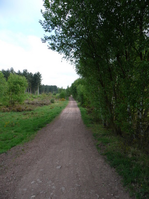
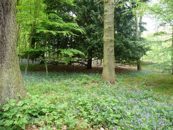
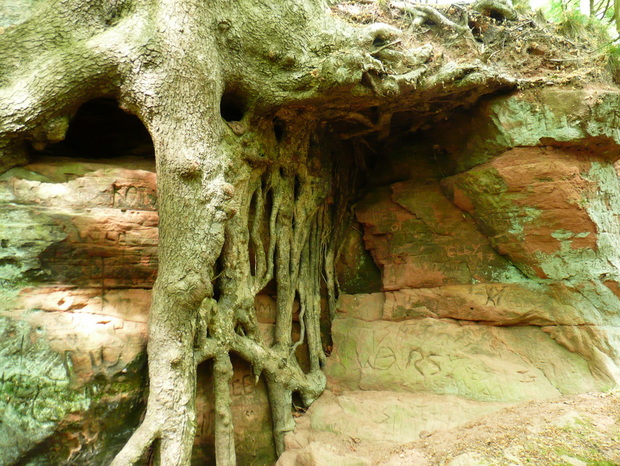
The path running along the southern edge of Clumber Park begins in a heavily wooded area, then straightens out and runs between hedges of young trees for a number of miles. This would have been a rather dull section, were it not for the fact that I was being followed about 1/4 mile behind by a man wearing dark clothing, with his hood up, on a warm sunny day. Not good for the paranoia, especially as I hadn't seen another living soul for about an hour. Eventually he dropped back, and I relaxed a little. Bluebells in Clumber. The path eventually left the woods and passed through fields before dropping down to a ford, then climbing back towards Hardwick Village. As I skirted Hardwick heading to the lake, I encountered an instructor from a "Boot Camp", who was looking for his trainees - I'd passed them a little earlier, shambling along through the woods. He asked me if I was orienteering! After following the lake, I rounded the main buildings at Clumber. I had intended to stop for a coffee, but decided to press on, and eat lunch on the hoof. I managed to hit the right path, but list the contents of my sandwich as I bit into it. Not ideal. I was really quite tired, and less than half the intended distance. The decision to dodge the cofffee wasn't a great one. The path running out towards Welbeck Abbey was extremely quiet, I only met one other person - a runner heading the other way, who did not acknowledge me. As the route dropped through a carving in the rock, my imagination ran riot. Very Lord Of The Rings.
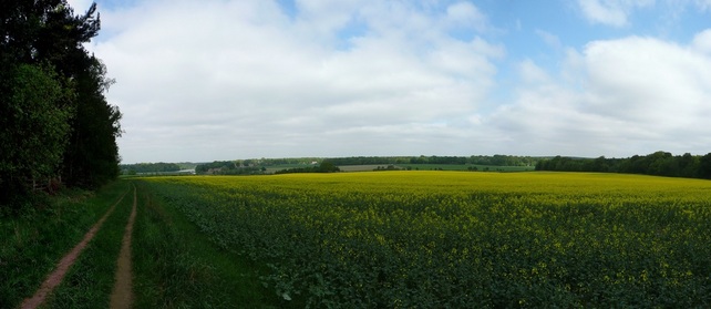
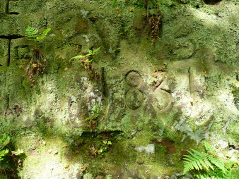
The carved graffiti had dates, some as early as the 1830's. Passing South Lodge, the path headed out across fields and towards Welbeck Abbey. Pretty much every turn I passed was marked as private, although the path remained clear ahead. Looked like a disused (WWII?) airfield just outside Welbeck.
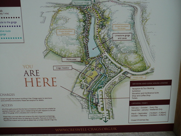
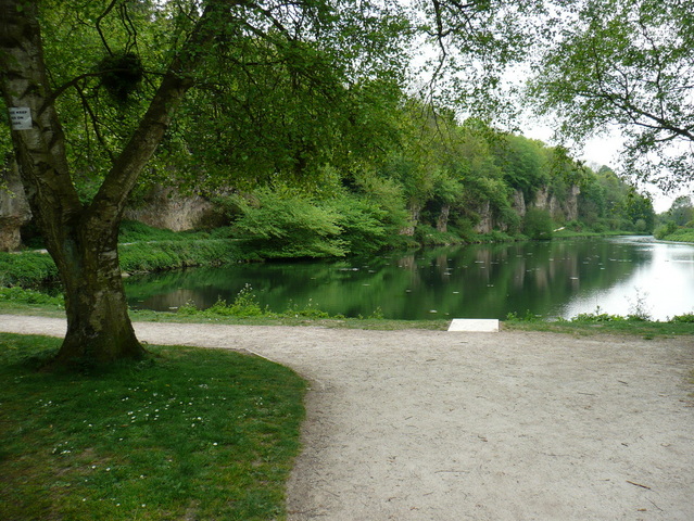
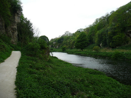
Pretty soon I reached the new visitor centre at Creswell Crags. I didn't really have time for Archaeology, but I did make time for a coffee.
Unfortunately, as I sat down to enjoy it, I somehow managed to sit on the bite valve of my drinks system, and so had the misfortune of sitting in a large puddle on the plastic chair. It took a few miles for my shorts to dry. Climbing the crags is strongly discouraged, and the kid in the red was about to get an earbashing. I stopped at this disused stile heading from Creswell to Holbeck to top up my snacks, empty a bottle of drink into my water system, and change my socks. 18 miles down, 8 planned miles to go.
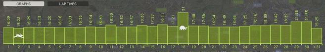
After Holbeck, I hooked up with what had the feeling of the driveway for a large house, presumably the Welbeck estate. I bypassed Norton, and once again crossed the A616 between Cuckney and Budby. Total route-finding fail. I picked up the wrong path just before the 24mile mark, and instead of heading directly back to the car, I speared out towards Meden Vale. I knew I was wrong when I reached a train line. My GPS watch battery had died without my realising, so I started a trace on my iPhone. I used Google maps to double check my position and the map to plan a route back. A short tantrum later, I was heading back towards Sherwood Forest. I took a shorter route back, and was soon back to the car. 28.8 miles in 9hrs34. I little further than intended, especially as I am training to complete a 29mile walk in under 10hrs 30.
Some good highpoints on the walk, more than made up for the mishaps, even my discovery (at home) that my shorts had completely disintegrated at the rubbing points. And the blisters.
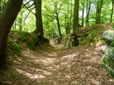
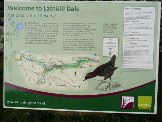
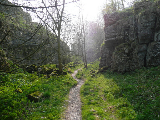
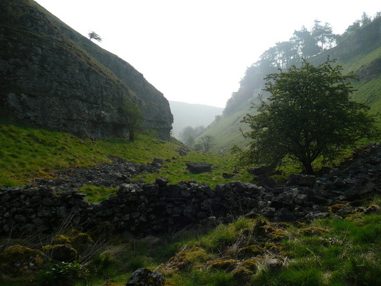
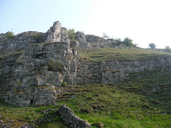
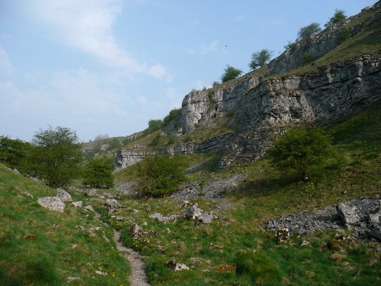
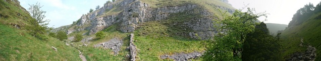
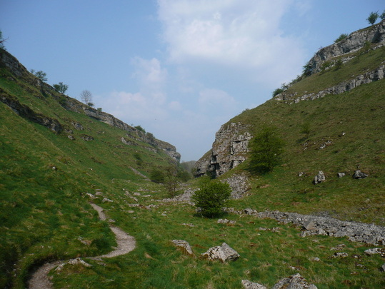
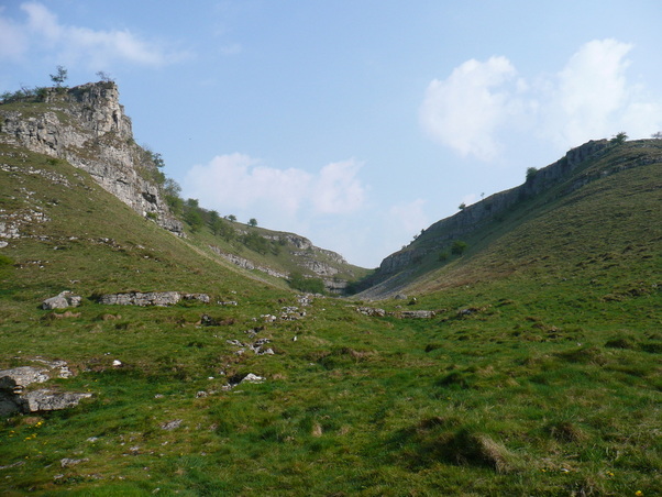
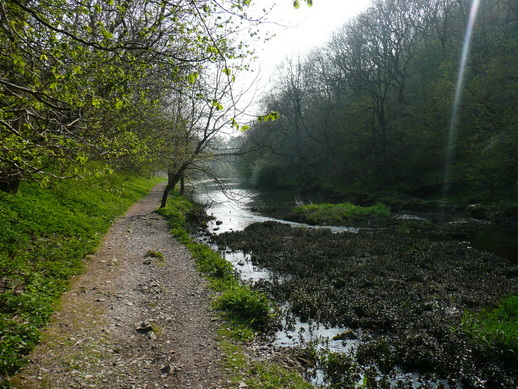
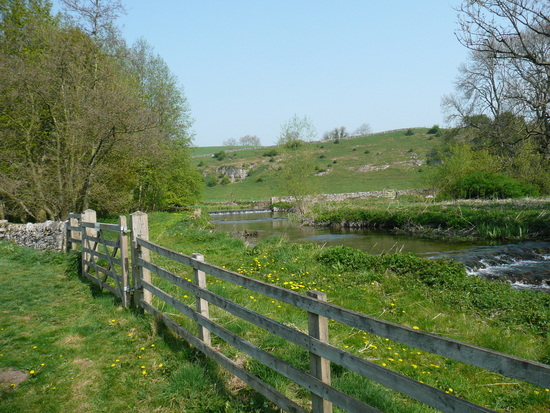
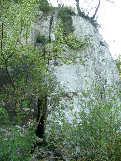
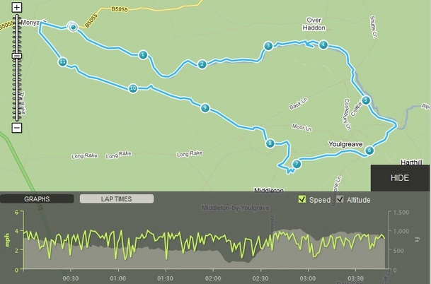
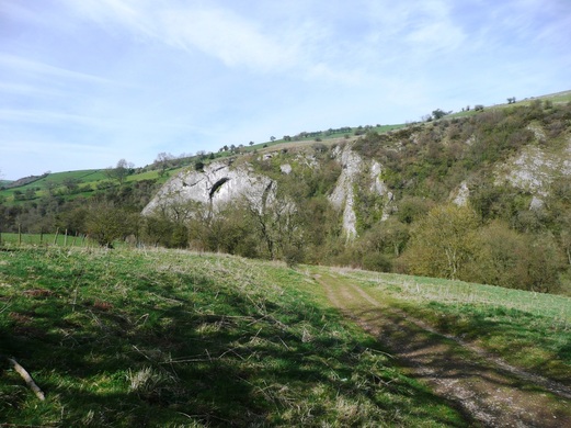
Upper Lathkill Dale is a crazed fantasy landscape of limestone cliffs and shattered rock. The path is rocky and uneven underfoot, so I had no hope of hitting my intended pace, especially while gawping at the geology. The path twists and turns between the crags.
A murder of crows wheeled overhead, adding to the atmosphere.
Come back in June :)
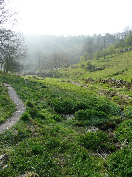
Sun came out about 10am, and beat down relentlessly for the rest of the day. After a while I convinced myself that I could smell the sea. While struggling with this thought, I realised that the vegetation in the bottom of the valley was damp. Soon this formed the start of the river Lathkill.
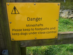
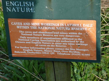
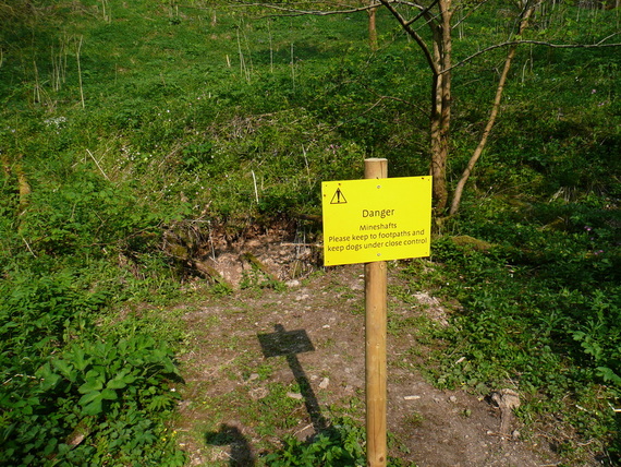
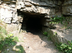
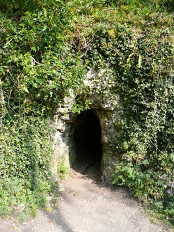
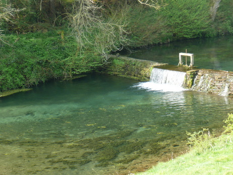
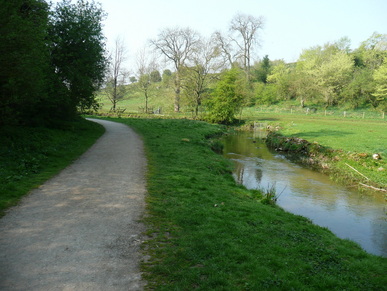
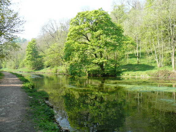
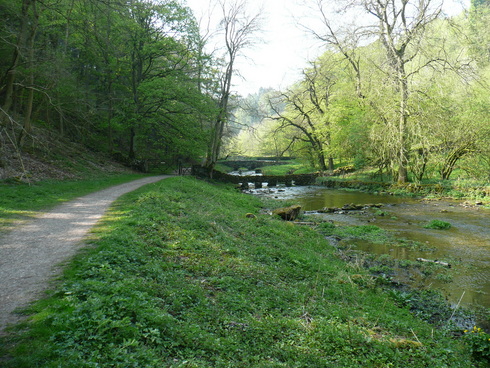
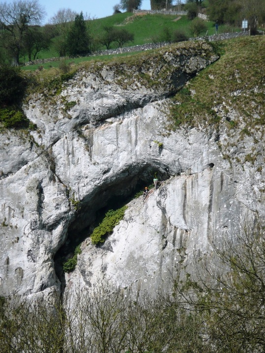
The river rapidly grew in size and stature, passing over a number of waterfalls. Incredibly clear water - all the way down. Camera's not really up to it at extreme zoom, but there was a Dipper playing in the waterfall. The path really felt to be in the river. There was a lot of birdlife in the woods. I could hear (but not see) a Woodpecker, and Chaffinches and a variety of tits flitted across the path. There were a lot of mines and caves along this stretch, and it seemed more popular with walkers. I made a navigational error at this point. The guide I was following said to cross the bridge and follow the old pack horse route down to Alport. I crossed a footbridge at a ford, and followed a rough track steeply uphill. Eventually I turned back, ego in tatters, as it was clearly wrong. To add insult to injury, a family I had steamed past were now once again ahead of me, and I had to "Hello again", as I went past.
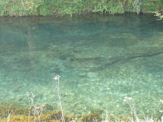
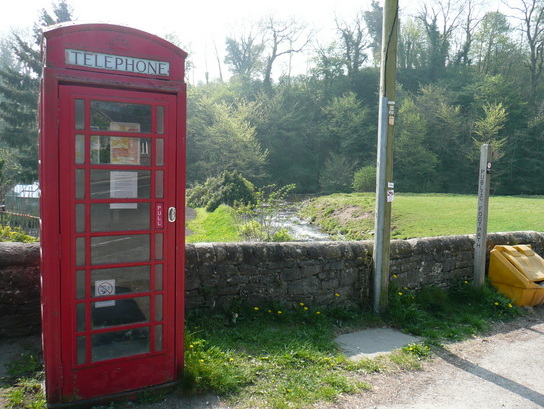
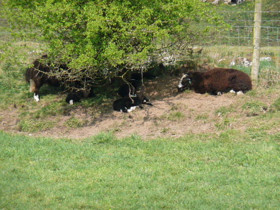
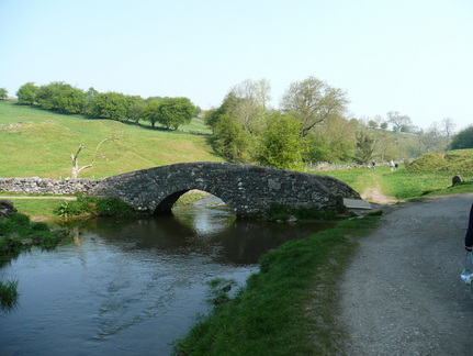
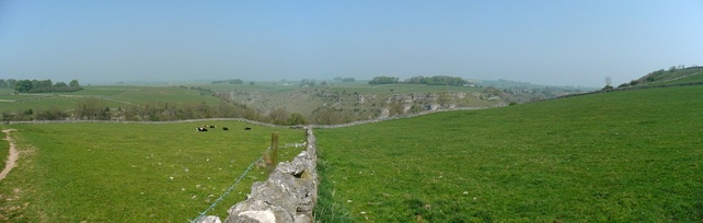
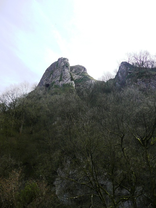
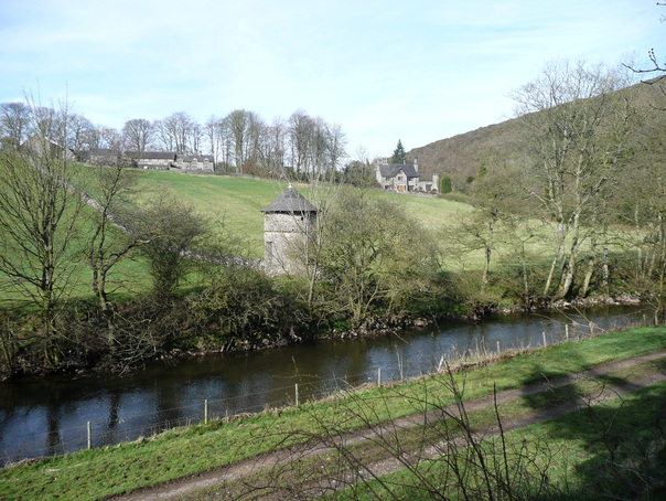
Incredibly clear blue water, but I never saw any fish or Heron. Crossing Conksbury Bridge there was a short period of road walking. At Alport the river Lathkill converges with the Bradford at a red phone box, and I changed rivers to complete the loop back up towards Monyash. The Bradford had a different character to the lower Lathkill, and I immediately warmed to it. This impressive crag had climbers slings hanging from an obvious belaying point higher up. And lots of crows. Jacobs (?) lambs keeping cool in the shade. 
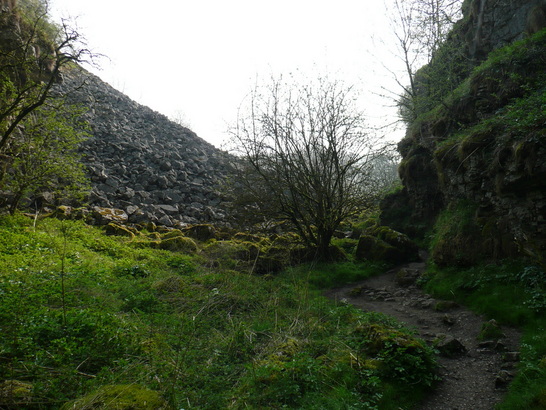
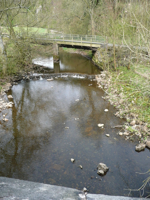
Eventually the Limestone Way crossed the river by some ruins, and climbed sharply by a zig-zag path up to Lomberdale Hall, a climb of nearly 1000ft.
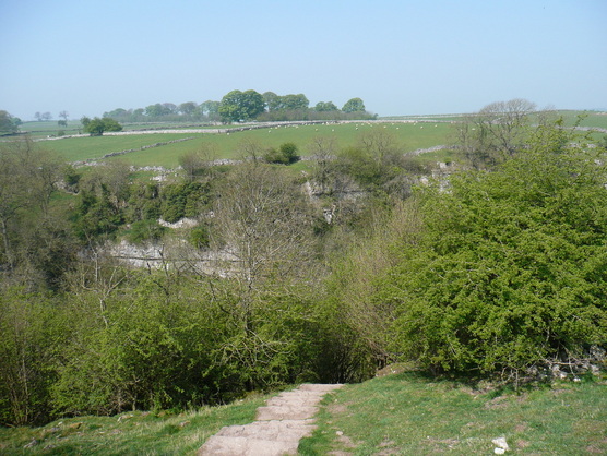
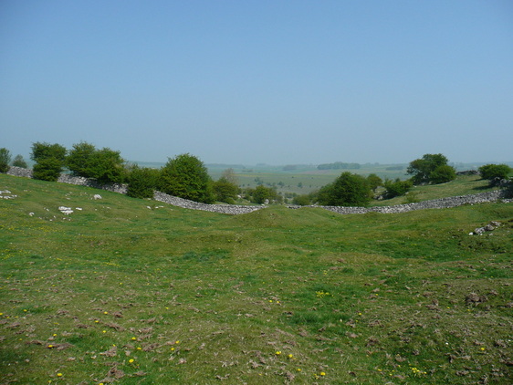
Eventually the climbing came to an end. The Limestone Way cut across fields for a few miles back towards Monyash. Impressive views back down towards Lathkill Dale
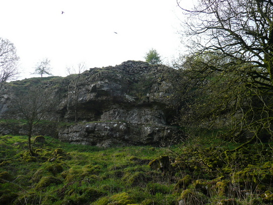
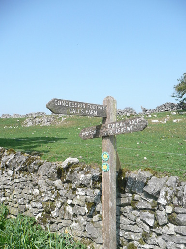
The path descends steeply into Cale Dale. Not good - I could see it continued on the other side, at the height I was climbing down from...
The path came out in a farmyard. From there it was across fields and down a "green lane" back to the carpark just outside Monyash. Given the late start, the need to finish early as I had things on in the afternoon, and the 1000+ft of ascent on a hot day, this walk was more strenuous than I had anticipated. Very enjoyable outing, though, and I would like to return to upper Lathkill again.
I had originally intended to start this walk from Retford, but with a late start due to watching the Quali for the 2011 F1 Chinese Grand Prix, and with plans for the evening, I got dropped off a few miles shorter, just outside Ranby, where there was easy access to the canal.
The intention was to follow the Chestefield Canal/ Cuckoo Way as far as Rother Valley, and hook up with the Transpennine Trail routes I have walked and biked before.
After a short stretch passing some well presented houses, I was out into attractive countryside with fields and brick-built bridges.
This stretch had a pleasing rural feel. I saw Heron, Canada Geese, and Lapwing.
The canal is navigable along this stretch, with occasional locks. The tow path was grassy and uneven underfoot.
Eventually I approached the outskirts of Worksop, with fishermen on the banks as I started to pass car dealerships and industrial buildings.
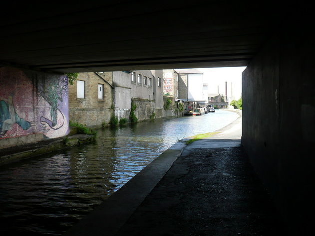
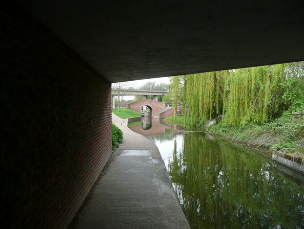
Things got a lot more urban as I edged up Canal Street towards the town centre. I've lived in some big cities, but never in my life have I seen discarded hyperdermics at the roadside. I was a little concerned about the underpass under the high street, but I was reassured by passing a family with young children, and decided to go for it. I hurried through, stooped under the road, and popped out by a new shopping centre.
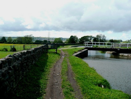
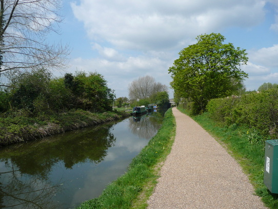
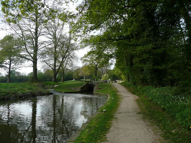
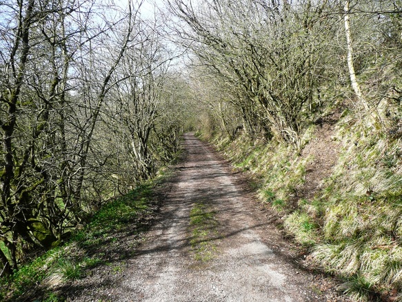
I was soon heading out of town and back into the country. The locks at Shireoaks have been restored, and the canal is very attractive pretty much all of the way to Kiveton Park. There were a number of narrowboats navigating the locks. The gates are held shut by water pressure until the levels equalise. I'd walked further than I thought. Soon I passed Kiveton Park station, and onto a short stretch of fisherman-filled canal which marked the end of the navigable section. The tunnel at Norwood is bricked up, and the path leaves the canal at this point. I had to "encourage" the horses out of the way to get out of the field, across the road, and onto Kiveton Waters. I can see what they tried to do with Kiveton waters. There are a load of fishing ponds there for the locals to come down to, and the rest of the old pithead is landscaped. It's nowhere near as successful as Poolsbrook. The toilets were locked up and there was obvious security, along with a warning sign that persons entering after dark did so at their own risk. Lovely.
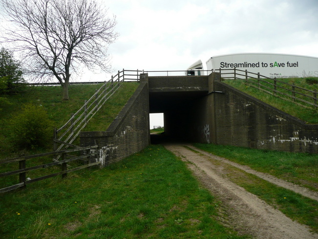
I pressed on across the park, and struck out towards the M1. The path ran along the edge of a wood as disused railway, then eventually headed out over fields to an underpass under the M1. From here I began to drop down towards Rother Valley Country Park. The path skirted woods an a series of ponds along a sort of "Millionaire's Row" with large, immaculately presented properties, and manicured lawns.
It felt odd, as if I was walking down their driveways. I had a strong sense of deja-vu, convinced that I had been here some years ago.
Eventually I reached the outskirts of Rother Valley, and after some navigation problems found my way towards the visitor centre.
Rother Valley was chaos, largely filled with people who had no intention of moving more than 20ft from their car, and busily burning black rectangles into the grass with their disposable BBQs.
I knew where I was now - one of my early training walks was an easy ten-miler back from here on a Sunday morning.
I decided to get my head down and make some time up. The Transpennine trail down to Staveley is along disused railway lines. It's good, solid paths, often edged with Silver Birch.
After racing a Shirehorse (!) down the TPT, I was soon home. Needed to resort to some pacy music, but I got home OK and in 7hrs 30. I did get a few blisters - blaming the Ron Hill socks for that.
Proper walking socks next time.
"Short" walk weekend this weekend, and glorious weather.
The penny has finally dropped that it may not be 13degrees, overcast, with a light drizzle on 22nd May. As such I need some warm weather kit to see me through the 29miler. A trip to Go Outdoors, and I have a Tilley Hat, a North Face walking shirt, and a pair of Saucony Progrid Xodus 2 trail running shoes. Cool feet and sun protection.
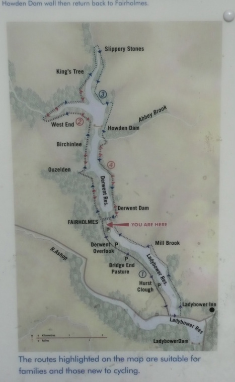
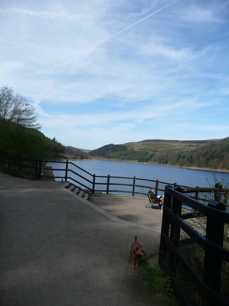
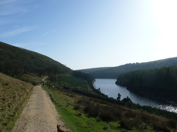
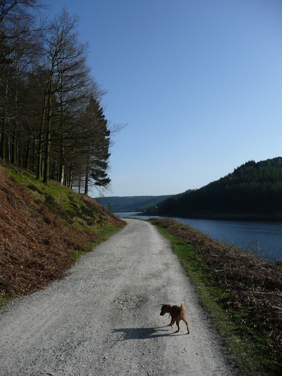
I watched the Malaysian Grand Prix in the morning, and after picking up the small dog it was well after lunch before I got to the Derwent Valley. It was packed. After queuing for half an hour I managed to get a spot in the Fairholmes carpark at the visitor centre.
At £2.5 for 2 hrs or £4 for all day, I was forced to head down to the visitor centre for an ice-cream to get change...
I've done the circuit of Ladybower a few times. I ran it many years ago, anticlockwise. I walked it last autumn anticlockwise. My strongest memory of this is the long road section at the end, when my feet were tired and my spirits low. So I did it clockwise this time.
It's definitely easier clockwise.
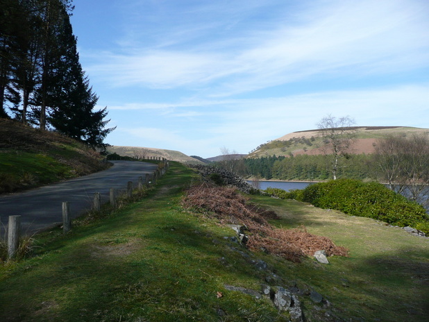
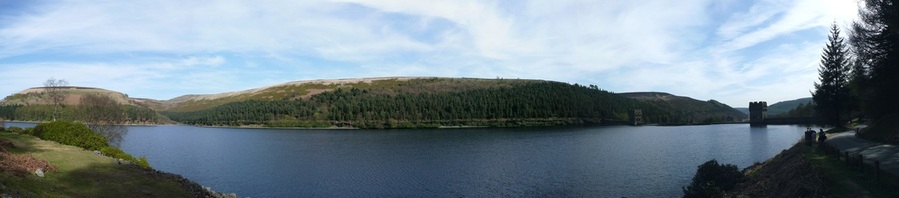
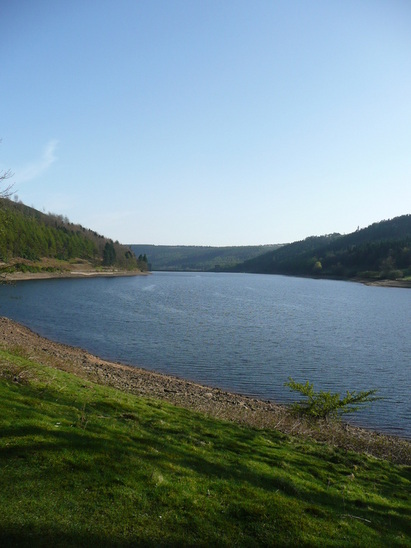
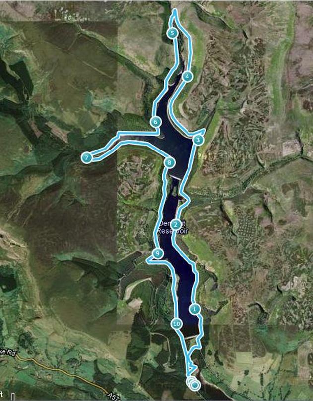
The route is just a circuit of the Y-shaped lake. There are a couple of dams on the route.
The road runs alongside the lake. There is a service bus which runs up and down, he passed me a number of times.
There were a phenomenal number of cyclists out. It was like Beijing. One family seemed disheartened that they set off away from me, stopped a little further on to get their breath back, and I would pass them as they were parked up.
They were planning to cross the second dam and return down the other side. Unfortunately this is not possible, as the dams are gated and closed off for the most part - you can't use them as bridges. They turned back instead.
Eventually I reached the turning circle at the end of the road. Things got a lot quieter from here on.
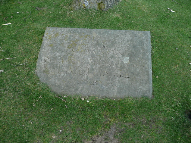
There is a tree in the centre of the turning circle with a plaque.
It makes reference to "The Royal Oak" and George VI planting the tree in 1945, but it's difficult to see in the picture.
I'm guessing there is probably a Dambusters link.
There was a river coming in from the left just after the road ended, so I was able to cool the dog off and get some water into her.
There are plenty of little streams coming down off the hillside, and she was drinking from these, but it was so hot I was keen to avoid her overheating. It was good to get off the road, and to have a reduction in the number of cyclists.
A good path ran up to the very end of the lake, and "Slippery Stones". A path continued from here up onto the moors, but after watering the dog again in the river, we turned across and began to follow the far shore of the lake back down the valley.
There was no shade at all on this section, and despite it only being the beginning of April, the sun beat down relentlessly. Despite her dip in the river, and regular drinks from streams crossing our path, small dog lost her appetite for walking uphill.
The valley is impressively steep sided - this is a view up to the crags overhead.
I've never walked along the top, but I fancy giving it a go some day
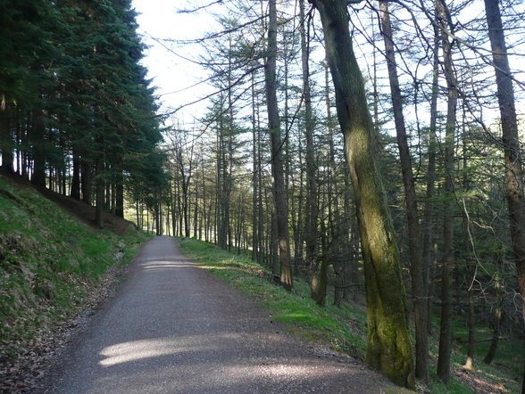
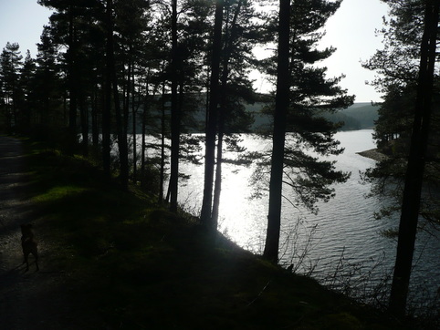
Eventually we dropped back in to the woods along the edge of the lake, and the dog perked up.
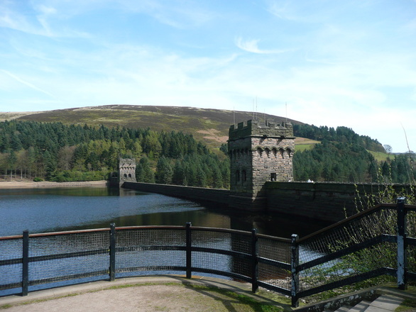
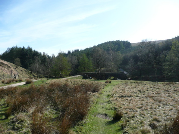
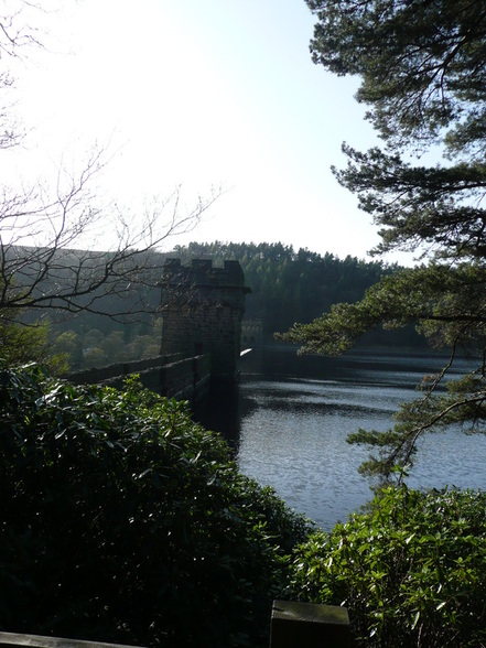
Back to the "second" Dam
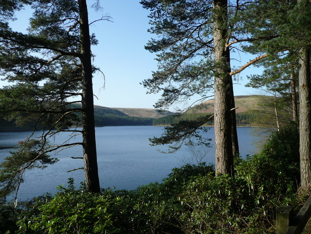
Looking back up the lake
We left the trees again on the final stretch back down to the "first" dam and Fairholmes carpark.
The dog spotted a sunbathing lizard on the path. I managed to lock the lead in time to save it, but it ran away into the dead bracken before I could get my camera out.
It was around 6pm by the time we got back to the car, and the carpark had cleared. The dog slept all the way home.
I had hoped for a faster time than 3hrs30, but given the weather (and how tired the pooch was), I think that was OK.
We weren't exactly pushing it.
This GPS trace is from last time I went around - I went round in the opposite direction, but it I had covered over a mile before the GPS locked in, so the distance is misleading.
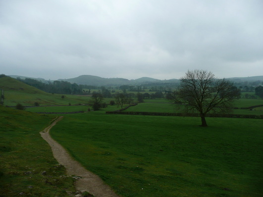
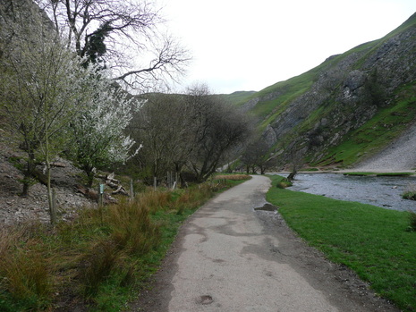
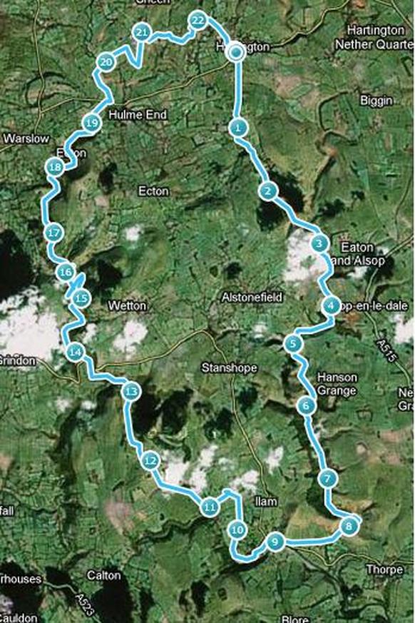
As a teenager, I did a two-day hike with my family, travelling from Hartington down the Dove, overnighting at Ilam Youth Hostel, and returning by the Manifold valley on the second day. As part of my training program for the 29miler, it seemed like an idea to walk this route in one day. I have walked sections in recent years, so have a good idea of the route, and from memory it should be fairly flat. I mapped it out using a piece of software and at an estimated 20miles, it looked pretty good.
After a bit of a late start (not ideal), I parked up by the Public Toilets at Hartington, and followed the path down the side of the gents, and out of the village towards the valley.
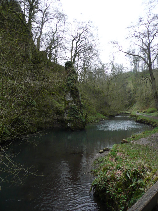
The steep-sided wooded gorge had an air of magic about it. The river looked clear and clean, and there was a limestone spire rising from the water which wouldn't look out of place off the shore of somewhere exotic.
Heavy showers dogged progress as in my indecision I swapped layers, and during a downpour stopped to dig out my proper waterproofs. The rain stopped immediately, and the clouds gradually lifted.
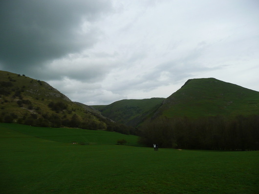
I left the woods, and entered the top of Wolfscote Dale.
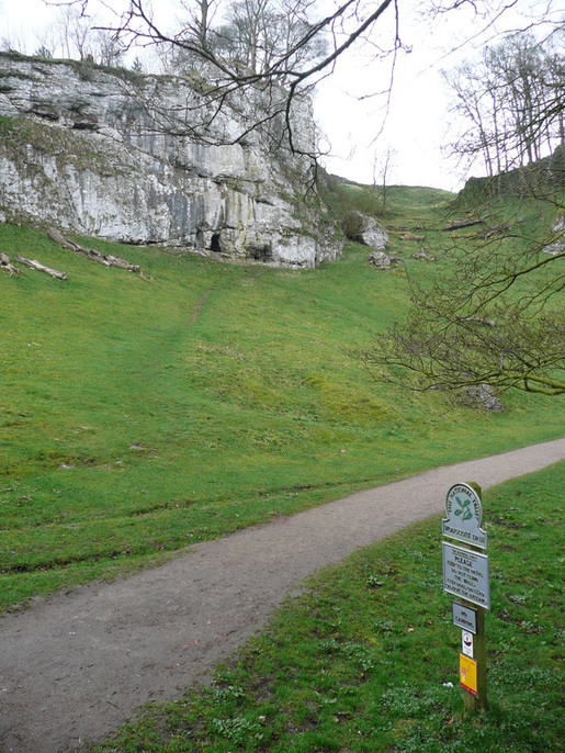
Wolfescote Dale has steep grassy sides with occasional areas of exposed limestone and caves right from the off - classic white peak. The paths are well maintained, and I began to meet a few other walkers.
At the lower end of Wolfscote Dale there is another cave up on the left, shortly before the National Trust centre (and toilets!) at Milldale.
Milldale also brought coach parties, and the first major decision of the day. Do I head up via Shining Tor, or trudge along a road section?
I decided that given the distance remaining, I would conserve my energy, dodge the hills, and take to the road. As luck would have it, there was a good path (so not actual road walking), and I was actually closer to the river than before - only a low wall separating me from the River Dove.
After the short road section, I was into Dovedale proper.
Picturesque, and busy. Sort of like a scaled-up Wolfscote Dale, but with coach parties of retired Ramblers, couples walking dogs, and school trips.
I had been enjoying the feeling of solitude, and was sad to lose it. The bumblies were blocking the path, and I put the hammer down. I was struck by how much it was like driving. Slow vehicle blocks the road, possibly a convoy, but you excuse yourself past, and they suddenly have the need to race you. The middle-aged gent in jeans with the small dog gave up pretty quickly, but a couple of the kids kept running alongside. I was into my stride, and the walking poles were working well, so I had a huge advantage of sure-footedness over the brief steep, rocky sections. They did well. It was nice to see a large group of young folk from ethnic minorities. There has been a lot of press recently that walking is almost exclusively a recreation for the white middle-class, and it was good to see the kids bucking the trend, and clearly enjoying it.
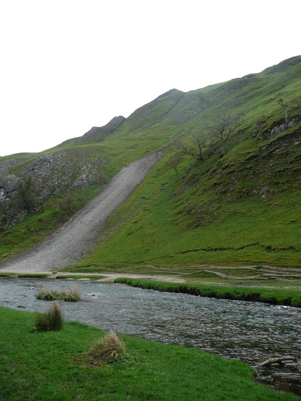
After a while I came to the stepping stones, and found myself alongside Thorpe Cloud.
I've done Thorpe Cloud before, so no guilt about passing it by without climbing it.
There was a queue at the icecream kiosk in the Dovedale carpark, so I bore right and took the path out into the fields and over towards Ilam.
Looking back, Thorpe Cloud looked more impressive than I remembered.
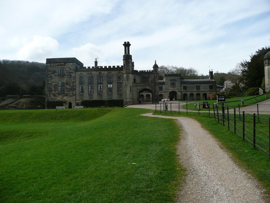
 Ilam is a pretty little village, little more than a few houses and Ilam Hall.
The path runs up to the hall and across and around the left-hand side, joining the route of the River Manifold.
The manifold is an odd river. I found the riverbed dry and barren, an untidy path of rocks and plastic bags. The path along the river ran through woodland, so there were few views. I emerged from the woods at Rushley, and had a minor route-finding crisis. I walked here a number of years ago, taking the path North to Castern Hall. But on this occasion I was to join the Manifold Trail. There was a couple out walking having similar problems, but I was able to direct them up to the hall as I crossed to the opposite side of the valley.
The path rose steeply out of the valley and out onto open fields. This felt like a steep pull, and a few cars were coming past as I walked up the single-track road. Walking poles are a Godsend. I was hauling hard on them as the incline steepened.
Looking back as I crested the climb:
 After a short distance, the ruins of Throwley Hall appeared over the horizon. There is a farm here and a Bed and Breakfast.
Crossing through the farmyard, the ground dropped steeply back down towards the valley, heading directly for Beeston Tor.
I spent a couple of minutes watching Climbers on Beeston Tor, then pressed on.
At Beeston Tor the path returns to the bottom of the valley, following the river bed. This is cyclist country. Flocks of them sweeping past at speed. I was feeling tired by now, but resisted using headphones, as I needed to keep an ear out for them approaching from behind.
I managed to motivate myself by thinking about having a cup of coffee and a kitkat at Wetton Mill.
Before long, Thor's Cave loomed high on the hillside up to the right. I recently visited the cave on a walk from Wetton, so felt happy about not climbing the 1000-or-so feet up to join the walkers on the top.
Just before Wetton Mill, the road forked. Taking the left branch, I was able to walk down to the point where the Manifold vanishes into underground caves. From this point on, I was walking alongside river again.
The river vanishes into a couple of holes between the rocks, the entrance to an underground cave system.
Wetton Mill has a cafe below some caves. Absolute lifesaver. After the best cup of dodgy coffee I have ever drunk in my life, a KitKat, and a few bottles of water back into my hydration system I was feeling a lot happier. There was another school trip here, a gang of about twenty girls laden down with camping equipment. They seemed pretty pleased to get to the cafe, and attracted all the wasps in the area with an orange Calippo.
I followed the Manifold trail up towards Ecton. The Manifold Way and Manifold Trail separate on this stretch, so the cyclists were all down on the other side of the valley, giving me some peace and quiet.
Ecton is an old mining town below Ecton Hill, with a church with a bright blue/green, presumably copper, steeple.
Afer Ecton the landscape opens out, and I left the valleys for open fields.
I followed the Manifold Way signs through Hulme End, and after a short road section bore right onto fields behind Hayesgate and over to Townend.
There was a group of Scouts at Townend taking a breather on a grass verge. They'd been out since 09:30, and covered the best part of nine miles. They seemed amazed that my GPS was reading twenty at this point.
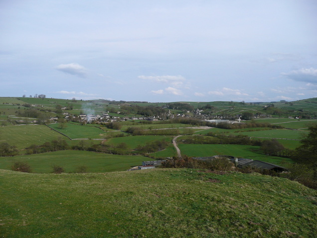
Another brief excursion over farmland, and I could see Hartington.
I was imagining that the smoke was rising from the fireplace in the Pub :)
I passed the site of the old Cheese Factory, as I remembered coming this way when I was a teenager. Sadly the factory is no longer in business, but the buildings remain.
Before long I was back at the car.
GPS software says 22.7miles, but it had a bit of a strop when I stopped at Wetton Mill for a coffee, so I think it's probably nearer 22.
It was a long day, but (barring the stretch from Ilam along the dry river) a very enjoyable one.
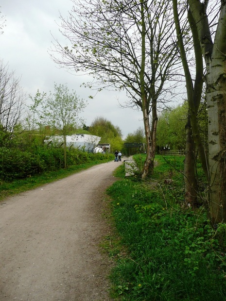
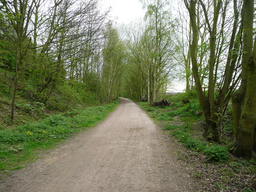
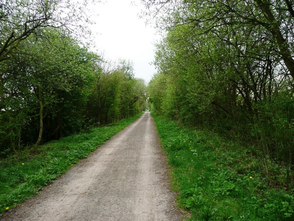
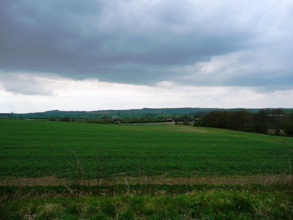
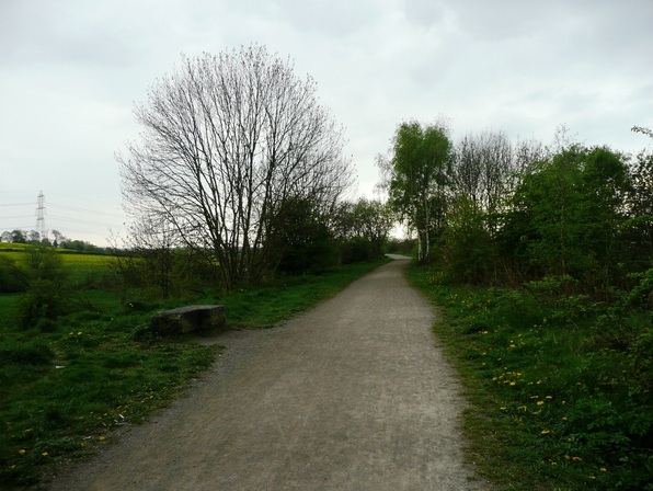
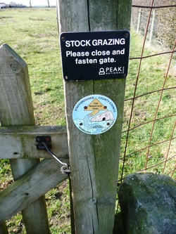
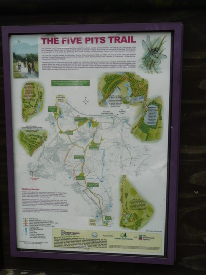
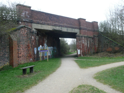
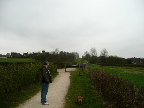
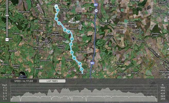
Supposedly a "short week" this week, so arranged to do 10ish easy miles along the 5pits trail from Corbriggs near Hasland over to Tibshelf, and back with Steve. Took the small dog. 5 pits trail runs through the old mining areas in North Derbyshire. see http://www.northwingfield.name/5pitstrail.htmDecent weather for the walk, today. A bit nippy and overcast, but this helped keep us cool while remaining dry, so we made good time.
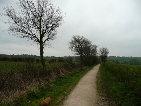
The trail winds along, mostly through fields and scrubland, only occasionally reaching housing.
We'd walked a section of the trail before, and the route finding was easy, so we made good time. The walk has great views (which I didn't photograph :D ), and has an enjoyably rural feel for a walk through what used to be a series of coalmines between Chesterfield and the M1.
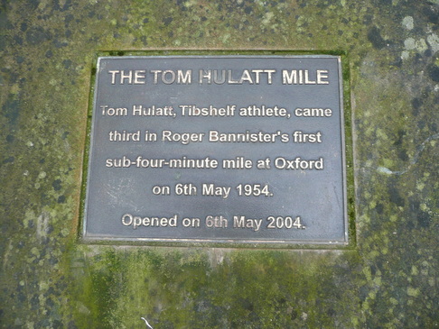
I'm vaguely related to Roger Bannister, donchaknow ;)
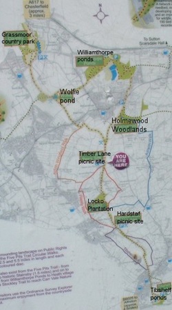
Tibshelf on the horizon. We turned back at the main road due to time pressure, and didn't do a loop of the ponds.
Googling to pull this quick blog together, I discovered the ponds are in fact a "meeting site" for men of a common interest. Not quite what we had in mind!
Return route was the reverse of the way out :) There is a pub at the Tibshelf end, and a shop selling drinks.
It was a good, enjoyable walk, with just the right amount of difficulty and hills to keep the challenge.
I've had a love/hate thing running with Kinder Scout since I was a teenager. I trudged up there with a youth group, had to retrieve by boot from a bog, and generally found it hard work.
A few years later, I walked up with some friends in winter. Saw Kinder Downfall frozen with icicles hanging upwards. Climbed up frozen waterfalls. Got horribly lost and ended up coming down the wrong side.
But a few years ago I visited with a friend on the shortest day of the year. We were very lucky with the weather, and had some fantastic views.
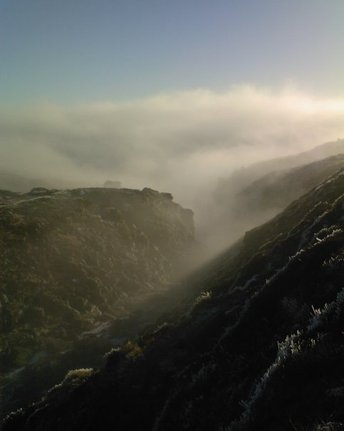
Last weekend, I went up Ringing Roger with the intention of walking the Edale Skyline round via Edale Cross, over Mam Tor, and back down by Hollins Cross.
Last weekend we did not have good weather. Last weekend was piss wet.
Things looked OK as we parked up in Edale and strolled past the visitor centre and up towards the Nags Head.
The Old Nags Head marks the official start of the Pennine Way. Our route passed the pub on the way out of the village, and led up towards Grindsbrook Clough before bearing right up The Nab, and on to Ringing Roger. The climb up the slope was steep and unrelenting, and I am not ashamed to say I struggled to keep pace with my walking buddies.
As we climbed we started to encounter a light haze of misty cloud, which cast a rainbow sheen across the hillside. We laughed and joked about being above the rainbow, but gradually the winds increased, and the rain grew ever more heavy.
As we scrambled up to the rocky top of Ringing Roger, the winds grew strong and blustery, and the rain came on more heavily.
Optimistic that things would improve, we pressed on westward along the edge, passing Nether Tor and Upper Tor. It's only a shower. It'll pass over.
It didn't.
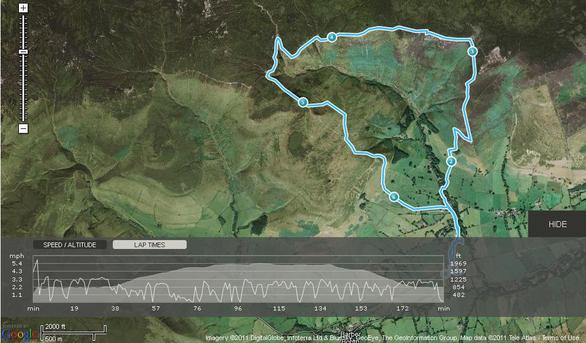
At the top of Grindsbrook Clough (the upper left point of the route on the map below) we decided that to carry on for another eight or nine miles while our "Durable Water-Resistant coatings" failed us would have been a bad idea, and turned south-east, aiming to use the path down over Grindslow Knoll as an escape route. We dropped down from the ridge into the lee of the wind in an attempt to alleviate the worst effects of the weather, but this traded the problem of wind and rain for the problem of uneven, steep, and boggy ground. We followed the contours around, and rejoined the path as it dropped to our level.
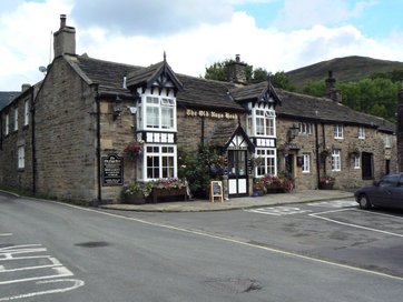
We headed back to The Ramblers pub to dry off. Mixed results on the food. Some of it was excellent, some of it was not, and they delivered the wrong meal after a 20minute wait, but made up for it with a free round :)
Might try the scramble up Grindsbrook Clough for a laugh next time. Looks like a fun route.
Kinder's not going to beat me. I'll be back, and in better weather.
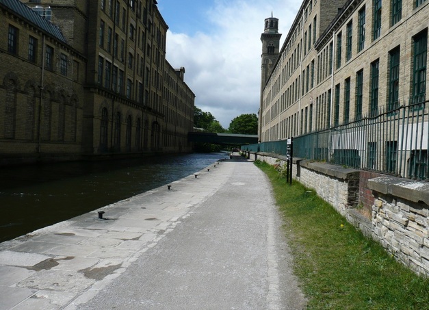
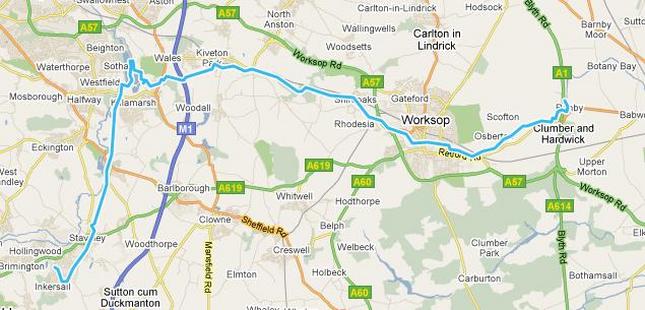
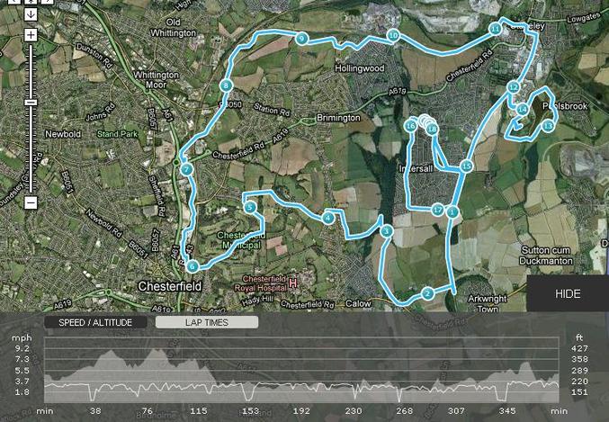
 I have rather foolishly agreed to undertake a 29mile walk from Leeds to Skipton for charity. Please sponsor me at http://original.justgiving.com/sigregory ;) My training programme includes a number of very long walks, gradually increasing in length. For the first I chose to walk a 16mile circuit around Chesterfield, with the my house roughly central, to allow for easy bail-out if my knees gave way. My companions on the walk were Steve, a collegue from work, and Sam, his Cockerpoo. Anticipating a long day, we set out across the football field and on to the Transpennine Trail. I forgot to take any photos, so pictures are either old photos I had lying around, or ones found on the 'net. If you find a photo i've "borrowed", and would like me to remove it from the page, please let me know. The Transpennine Trail is a long distance path which runs from coast to coast, as the name suggests. There is a North/South section which crosses the trail, and this intersects with the Cuckoo Way, another long distance path along the Chesterfield canal.The section of the TPT nearby is a disused railway line which served the pits which used to dot the landscape of NorthEast Derbyshire. This makes for shallow gradients, and easy walking on good paths. We followed this track towards the new site of Arkwright town. Leaving the railway line we turned right across fields until we reached a farm track, which we followed to the main road, turning right towards Calow. The road walking was only brief, a footpath from the back of the carpark of The White Hart taking us back onto farmland across the back of the Royal Hospital. Some dodgy route-finding led us down a muddy path into the Westwood, rather than skirting the edge. After jumping over some brightly-coloured streams, and slithering about we found the link from the TPT heading from Inkersall through the back of Brimington Common, and out into the countryside heading towards Tapton. The drop down alongside Tapton was probably the scenic highlight. There was a surprisingly rural feel, considering how close we were to Chesterfield town centre. The path was good underfoot, and we made good time down towards Tapton House. Sam was excited by the large pond which we passed to our right, before turning left along a short road stretch down to Tapton Golf course. Construction works were ongoing at the bottom of the Golf Course. There is a planned redevelopment along the Chesterfield Canal, and presumably this forms part of it. Crossing under the station we reached the canal proper. Time to stash the map, easy route-finding from here on. We followed the canal up to Tapton lock. The initial stretch of canal is very urban, passing between the site of the old Trebor factory and the back of the old Arnold Laver site. However, once past the fork where the River Rother branches left, and the canal branches right, things improve greatly, and soon we reached Tapton Lock. There is a small visitor centre here, and toilets. Revived by a break and a snack, we pushed on. There is an uninterrupted 4 mile stretch of canal running from Tapton Lock up to Staveley. Well, in theory. Once past The Mill pub, We were back out into the country, the peace only interrupted by Sam attempting to catch ducks, and by the stench of the sewerage works, which spoils a long stretch leaving Chesterfield. We were glad to leave it behind as we approached a lock near Hollingwood, only to be greeted by a diversion due to restoration works. This required us to head to the road and bypass around on Station Road, rejoining the trail near the junction with Works Road. Back on the canal path up to Staveley. I was familiar with this section, having cycled and walked on it last year. However when we reached the end of the restored section at the bridge at Staveley, we were greeted by another closure and diversion, and a representative of Chesterfield Canal Trust who was collecting signatures to apply for funding to continue the restoration. I have visited the section which is still under restoration, and it will be beautiful once finished, and an asset to the area. I hope they are successful. This diversion skirted the centre of Staveley and brought us back on to the Transpennine Trail by the Fire Station. Again, I was familiar with this stretch, and we followed the disused railway line until the branch to Poolsbrook Country Park, site of the former Markham Colliery.My training regime suggested that I should be aiming to walk 16-18 miles, and I was worried about mileage. We put in a wide loop around Poolsbrook, taking in all three lakes and the hill by the caravan park, then regained the trail. A short pull remained up to Inkersall. I was still down on mileage, but decided to return Steve, his blisters, and Sam to their car, and put in a loop around the west side of Inkersall by myself. Given how muddy we had found the Westwood, I revised my planned route, and stuck to the road. I've been doing this loop a lot, as it is well lit, and the requirement to put in 4-5 miles every other evening is well met by doing two loops around the circuit. If tackled clockwise it provides a long uphill pull from the TPT, then an enjoyable undulating descent across open grassy areas along the edge of the Westwood. Returning home, I checked the GPS and it was reading 18.11 miles. The mapping software I had used to plan the route had suggested 16.5miles, but the diversions and a spot of poor routefinding had pushed things up a bit. Time was under 6hrs 30, which felt good for a first effort, and not far off my planned 3 mph average.
|

 RSS Feed