Saturday morning 04:30, and after an accidental wine-fuelled late night, my alarm goes off. I grab my gear and a coffee, nearly forget my drinks bladder, and am just about ready when my lift to Wales arrives.
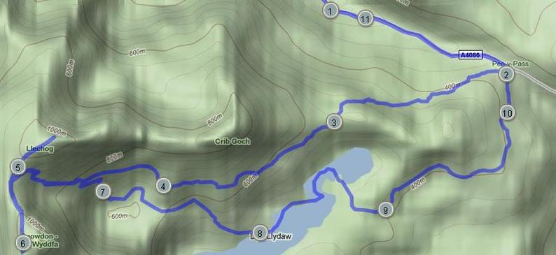
We're booked in to the Pen Y Pass youth hostel for that evening, and the plan is to get there for 8am, climb Snowdon by Pyg and Miners' paths, and retire to the bar. Options on Carnedd Ugain and Y Lliwedd, depending upon time and conditions.
Things didn't quite pan out that way. The Manchester ring road was closed near to Manchester Airport. We had sat-nav problems and a poorly signposted detour, which caused no end of grief. Eventually we found our way along the North Wales coast (via a McBreakfast and a SatNav special over a mountain through a forest) and arrived at Pen Y Pass about 10am. Two hours behind schedule.
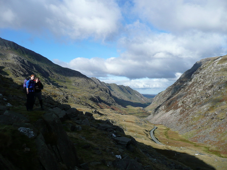
Nowhere to park, so we ended up 2 miles (and 500ft) down the valley near Nant Peris.
Clearly shuttle buses are for girls, so we yomped back up to P-Y-P in about 40 minutes, and hit the Pyg.
We're booked in to the Pen Y Pass youth hostel for that evening, and the plan is to get there for 8am, climb Snowdon by Pyg and Miners' paths, and retire to the bar. Options on Carnedd Ugain and Y Lliwedd, depending upon time and conditions.
Things didn't quite pan out that way. The Manchester ring road was closed near to Manchester Airport. We had sat-nav problems and a poorly signposted detour, which caused no end of grief. Eventually we found our way along the North Wales coast (via a McBreakfast and a SatNav special over a mountain through a forest) and arrived at Pen Y Pass about 10am. Two hours behind schedule.
Nowhere to park, so we ended up 2 miles (and 500ft) down the valley near Nant Peris.
Clearly shuttle buses are for girls, so we yomped back up to P-Y-P in about 40 minutes, and hit the Pyg.
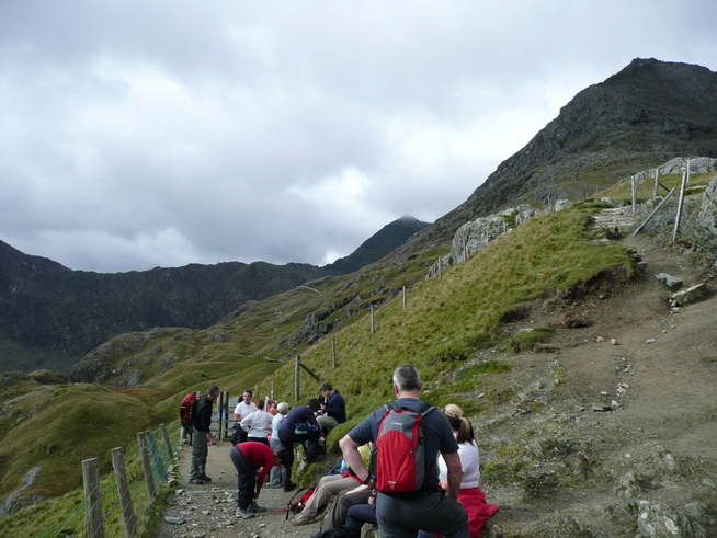
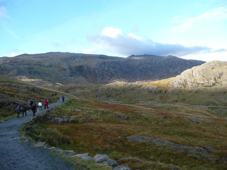
Oh My God. The Pyg track was like Princes Street in the run up to Christmas. I had an older lady snapping up my heels to the extent that she actually pushed my rucksack as I stepped my way up the initial steep section. Getting out of their way, it transpired that they were an organised party with a guide, who was a clueless idiot. He made them put on all their layers and frog-marched them up to the bwlch. when I arrived they were a sweaty mess of complaints. Always set off cold - I was in a t-shirt and warming through nicely.
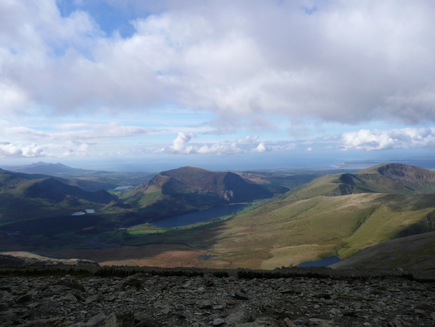
This was our first view of the route. The Pyg starts on the outside of the arm which becomes the Crib Goch ridge. As you cross at the bwlch the view opens up. Snowdon summit is briefly visible, as is Llyn Llydaw and Y Llywedd across the other side.
Once the pushy party were away off up to Crib, things improved and everyone spaced out as they got into their natural walking rhythm. The path runs almost flat until it gets up above Glaslyn below the summit, then climbs steeply.
We had considered our route carefully, and opted for Pyg and Miners' because it offers a horseshoe walk with accommodation near the start/end. We hadn't planned on an epic road walk at either end. We had considered Crib Goch, especially after enjoying Halls Fell so much, but given the mixed forecast had decided against it. Talking to walkers on Carnedd Ugain, Crib was extremely busy, and was frustrating to fast and slow walkers alike.
The cloud base was moving down as we walked, and Crib Goch above us vanished into the murk. Correct route choice in avoiding that!
The steeper section at the head of the valley caused problems for the walkers who weren't used to rocky mountain paths. The initial sections are "built" paths - basically a paved highway. The steeper sections are exposed bedrock with occasional sections of jagged exposed slate ends. There are also some sloping wet slabs which must be crossed - this would be dicey in winter. Walking poles seemed to be a hindrance to those using them. There were one or two bits where a hand on the rock gives extra confidence.
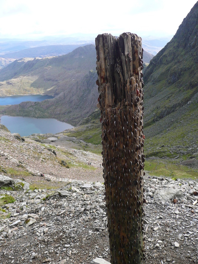
High on the Pyg above where the Miners joined in we came across this pole. A Telegraph pole with coins wedged into all the gaps. Very odd.
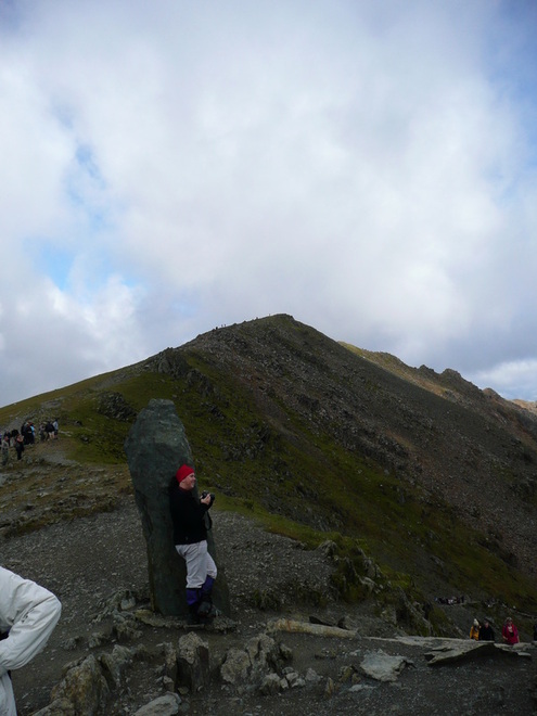
The top of the Pyg is marked by this large slate stone. Carnedd Ugain is shown behind it - our first summit for the day.
Sadly this is also the point where you join the chav superhighway coming up from Llanberis, and the parallel traintrack.
The cloud had risen at this point, so we set off to the summit, and away from the crowds heading to Snowdon.
Sadly this is also the point where you join the chav superhighway coming up from Llanberis, and the parallel traintrack.
The cloud had risen at this point, so we set off to the summit, and away from the crowds heading to Snowdon.
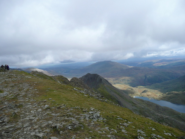
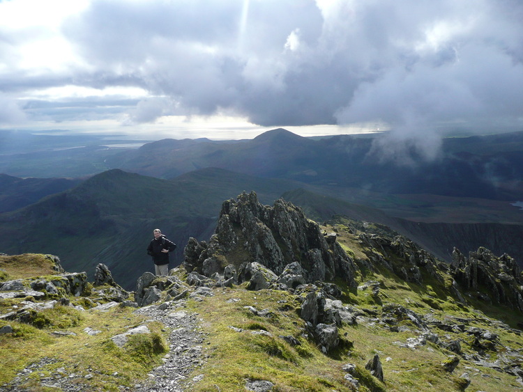
We climbed Carnedd Ugain up a slope covered in jagged slate rubble. Fantastic summit with views over Crib Goch and back across to Snowdon.
The Sodding Train. The track runs up parallel to the Llanberis path to the new Hayfod Eyri complex at the summit of Snowdon.
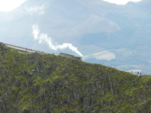
We buckled down and pressed on towards the summit of Snowdon. We could see a train coming up from down the valley, and as it is common for there to be queues at the summit cairn, we decided to press on quickly, despite cramping thighs.
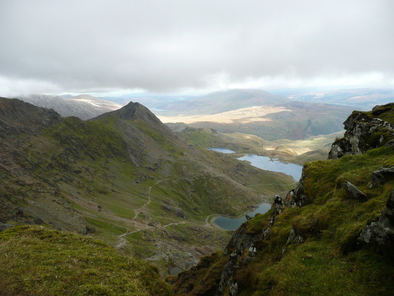
The view back down the Pyg, with Llyn Llydaw and Glaslyn - before the clouds closed in.
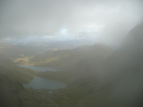
As we neared the summit, the weather turned. The clouds which had lifted during the morning descended rapidly, and visibility dropped to a few feet. We raced up the steps to the heavily constructed summit cairn, and tagged the summit through the crowd.
Below us lay the cafe and train station. The Hayfod Eyri centre. It was awful. Water tanks and scaffolding restricted access to the south face. There was a queue of over 20 minutes for coffee, and the line ran out of the door. A train had just arrived, and the little old ladies were all complaining at the lack of a view.
Gangs of muscle-bound morons were quaffing lager, and the whole place stank of toilets, testosterone, and steam trains.
We decided to find a quiet-ish patch of rock, have a break, and see if things improved.
Eventually the weather lifted, and we set off in search of the path to Y Lliwedd, and a descent down the southern arm of the cwm.
Unfortunately, the weather closed back in at this point, and we were unable to find the top of the path. We retraced our steps back to the top of the Pyg ready for a descent by the Miners' Path
After a rapid descent down the rocky Miners' Path, pausing only to rescue a distressed child who had been left to fend for herself halfway down a crag by her parents, we arrived at Glaslyn, having dropped out of the weather.
Glaslyn has a beach, which was full of resting walkers sunbathing and taking a dip in the bright green water. The water colouration is a result of contamination with copper from mining work. Not sure i'd be swimming in that.
Glaslyn has a beach, which was full of resting walkers sunbathing and taking a dip in the bright green water. The water colouration is a result of contamination with copper from mining work. Not sure i'd be swimming in that.
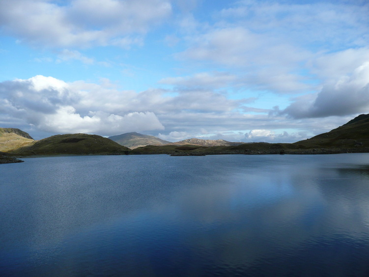
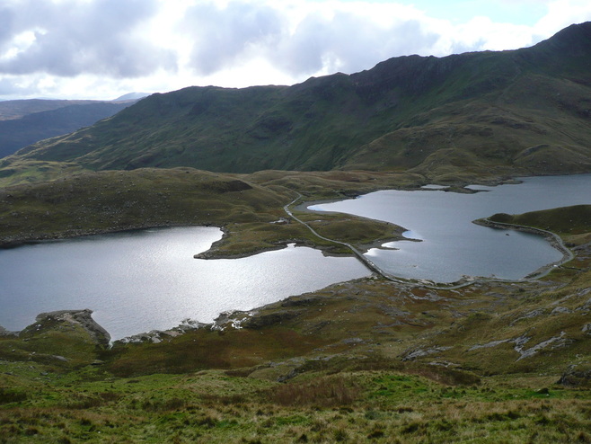
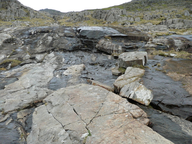
The path follows around the line of Glaslyn and the twin lakes of Llyn Lydaw with it's causeway. There are old mine buildings along the shore of the lake.
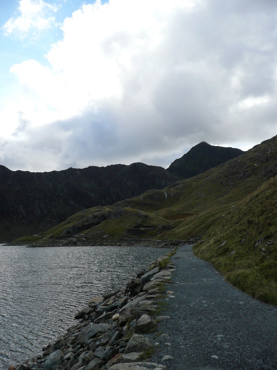
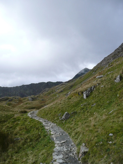
We followed the Miners' Path back around the end of the valley and back to Pen Y Pass
After checking in at the Youth Hostel, only a 2 mile road walk back down to Nant Peris stood between us and a meal in the Vaynol Arms.
Finished off with a number of pints of nutritious Guiness in the hostel bar :D
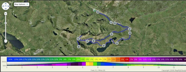
After 12 miles and over 3500ft of ascent, then descent, we figured we'd earned it. Even the YHA beds were comfortable (if 6" too short for adult males).
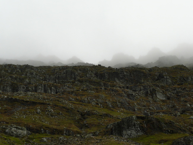
Next morning looked like this -
Finished off with a number of pints of nutritious Guiness in the hostel bar :D
After 12 miles and over 3500ft of ascent, then descent, we figured we'd earned it. Even the YHA beds were comfortable (if 6" too short for adult males).
Next morning looked like this -
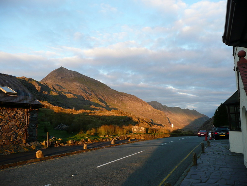
We had to be out of the Pen Y Pass carpark by 9am to avoid getting a parking ticket, so we headed down the Llanberis Pass.
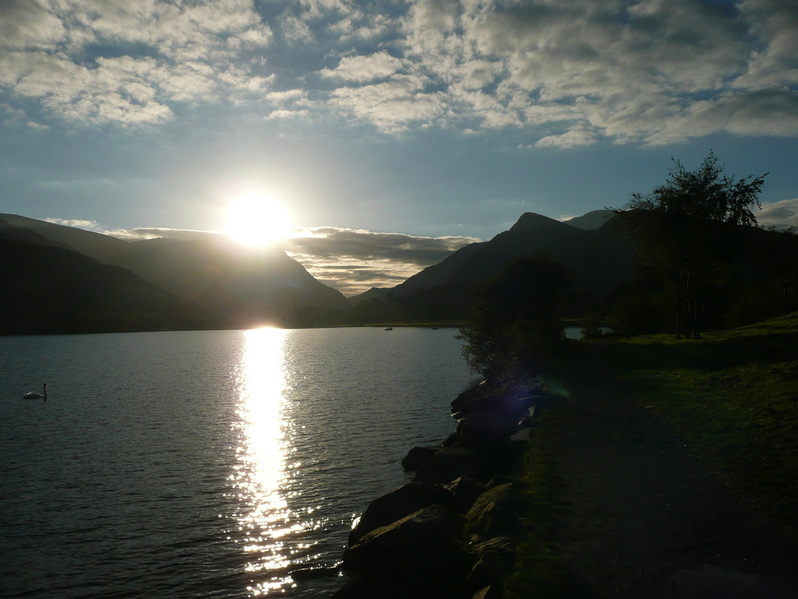
The carpark on the lake at Llanberis is cheap - 70p for an hour.
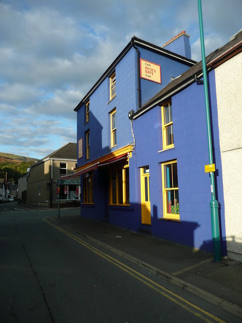
And ideally situated for a breakfast and a pint of tea at Pete's Eats, top climber's cafe. Free wifi, and they even offer showers (£2 with soap and towel) and accommodation for walkers and climbers.
 RSS Feed