I have rather foolishly agreed to undertake a 29mile walk from Leeds to Skipton for charity.
Please sponsor me at
http://original.justgiving.com/sigregory ;)
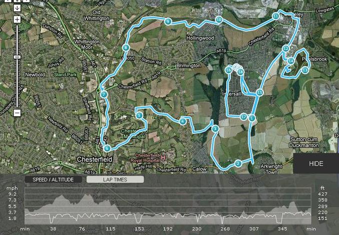
My training programme includes a number of very long walks, gradually increasing in length. For the first I chose to walk a 16mile circuit around Chesterfield, with the my house roughly central, to allow for easy bail-out if my knees gave way.
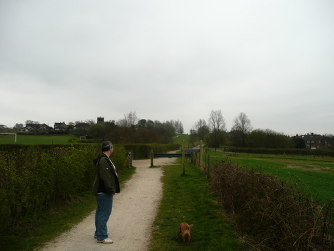
My companions on the walk were Steve, a collegue from work, and Sam, his Cockerpoo.
Anticipating a long day, we set out across the football field and on to the Transpennine Trail.
I forgot to take any photos, so pictures are either old photos I had lying around, or ones found on the 'net.
If you find a photo i've "borrowed", and would like me to remove it from the page, please let me know.
The
Transpennine Trail is a long distance path which runs from coast to coast, as the name suggests. There is a North/South section which crosses the trail, and this intersects with the Cuckoo Way, another long distance path along the
Chesterfield canal.The section of the TPT nearby is a disused railway line which served the pits which used to dot the landscape of NorthEast Derbyshire. This makes for shallow gradients, and easy walking on good paths. We followed this track towards the new site of
Arkwright town. Leaving the railway line we turned right across fields until we reached a farm track, which we followed to the main road, turning right towards Calow. The road walking was only brief, a footpath from the back of the carpark of The White Hart taking us back onto farmland across the back of the Royal Hospital.
Some dodgy route-finding led us down a muddy path into the Westwood, rather than skirting the edge. After jumping over some brightly-coloured streams, and slithering about we found the link from the TPT heading from Inkersall through the back of Brimington Common, and out into the countryside heading towards Tapton.
The drop down alongside Tapton was probably the scenic highlight. There was a surprisingly rural feel, considering how close we were to Chesterfield town centre. The path was good underfoot, and we made good time down towards Tapton House. Sam was excited by the large pond which we passed to our right, before turning left along a short road stretch down to Tapton Golf course.
Construction works were ongoing at the bottom of the Golf Course. There is a planned redevelopment along the Chesterfield Canal, and presumably this forms part of it.
Crossing under the station we reached the canal proper. Time to stash the map, easy route-finding from here on.
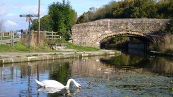
We followed the canal up to
Tapton lock. The initial stretch of canal is very urban, passing between the site of the old Trebor factory and the back of the old Arnold Laver site. However, once past the fork where the River Rother branches left, and the canal branches right, things improve greatly, and soon we reached Tapton Lock. There is a small visitor centre here, and toilets.
Revived by a break and a snack, we pushed on. There is an uninterrupted 4 mile stretch of canal running from Tapton Lock up to Staveley. Well, in theory.
Once past The Mill pub, We were back out into the country, the peace only interrupted by Sam attempting to catch ducks, and by the stench of the sewerage works, which spoils a long stretch leaving Chesterfield. We were glad to leave it behind as we approached a lock near Hollingwood, only to be greeted by a diversion due to restoration works. This required us to head to the road and bypass around on Station Road, rejoining the trail near the junction with Works Road. Back on the canal path up to Staveley.
I was familiar with this section, having cycled and walked on it last year. However when we reached the end of the restored section at the bridge at Staveley, we were greeted by another closure and diversion, and a representative of
Chesterfield Canal Trust who was collecting signatures to apply for funding to continue the restoration.
I have visited the section which is still under restoration, and it will be beautiful once finished, and an asset to the area. I hope they are successful.
This diversion skirted the centre of Staveley and brought us back on to the Transpennine Trail by the Fire Station. Again, I was familiar with this stretch, and we followed the disused railway line until the branch to
Poolsbrook Country Park, site of the former
Markham Colliery.My training regime suggested that I should be aiming to walk 16-18 miles, and I was worried about mileage. We put in a wide loop around Poolsbrook, taking in all three lakes and the hill by the caravan park, then regained the trail.
A short pull remained up to Inkersall. I was still down on mileage, but decided to return Steve, his blisters, and Sam to their car, and put in a loop around the west side of Inkersall by myself. Given how muddy we had found the Westwood, I revised my planned route, and stuck to the road.
I've been doing this loop a lot, as it is well lit, and the requirement to put in 4-5 miles every other evening is well met by doing two loops around the circuit. If tackled clockwise it provides a long uphill pull from the TPT, then an enjoyable undulating descent across open grassy areas along the edge of the Westwood.
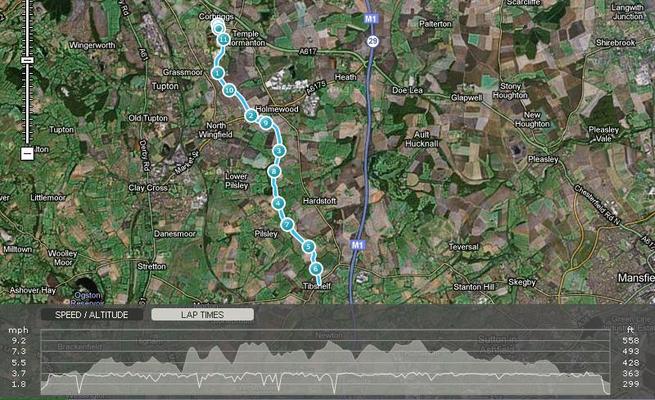
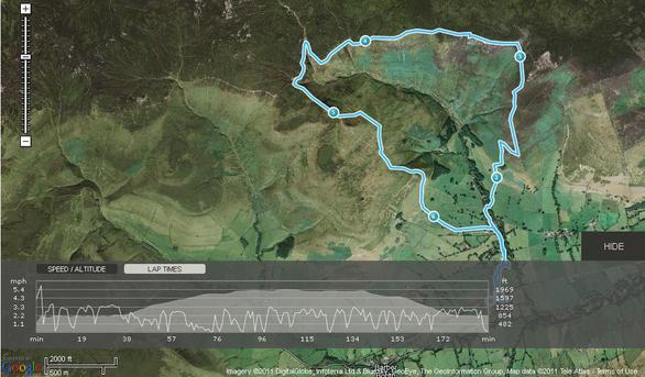
Returning home, I checked the GPS and it was reading 18.11 miles. The mapping software I had used to plan the route had suggested 16.5miles, but the diversions and a spot of poor routefinding had pushed things up a bit.
Time was under 6hrs 30, which felt good for a first effort, and not far off my planned 3 mph average.
 RSS Feed