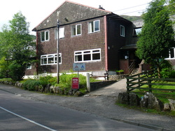
Twelve months of anticipation and over 400 miles of training walks saw me awake at 6am in the Glen Nevis SYHA having had little sleep, and still suffering from the effects of a 72hr "24hr" viral stomach upset. I had hardly eaten or slept since Friday, and here I was on the Sunday morning, wishing I had baled out when I had the chance.
I had returned home from work on the Thursday to find my family all ill. My heart sank with the crashing inevitability, and sure enough I just about made it back into the house after a Friday spent on the motorway visiting a customer site, when I joined them.
The planned 8am start was pushed back to late morning as I dosed up on immodium and anti-nausea meds from the local chemist, but I figured that as the others had perked up after a day or so, I would be OK. I just needed to get through the 370mile journey up to Fort William, and stay hydrated.
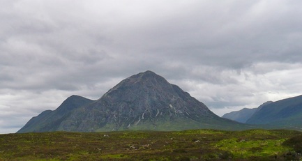
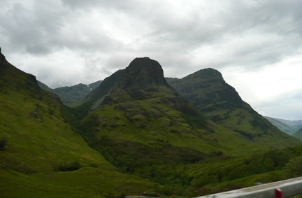
Only I didn't really improve. I perked up a bit at Glen Coe, but I still couldn't sleep or keep any food down.
I had returned home from work on the Thursday to find my family all ill. My heart sank with the crashing inevitability, and sure enough I just about made it back into the house after a Friday spent on the motorway visiting a customer site, when I joined them.
The planned 8am start was pushed back to late morning as I dosed up on immodium and anti-nausea meds from the local chemist, but I figured that as the others had perked up after a day or so, I would be OK. I just needed to get through the 370mile journey up to Fort William, and stay hydrated.
Only I didn't really improve. I perked up a bit at Glen Coe, but I still couldn't sleep or keep any food down.
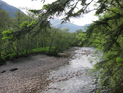
We grabbed a few supplies, and half a burger, in Fort William, and headed up to Glen Nevis for the night.
Which takes us back to where we came in. I knew I was in no state to tackle our planned route via the CMD arete. There was a forecast for high winds coming in late afternoon, so a delay could have potentially been dangerous. I was a couple of hours later out of bed than planned, weak, and already dehydrated. I wasn't even sure I could tackle the tourist route, but I was sure as hell going to try.
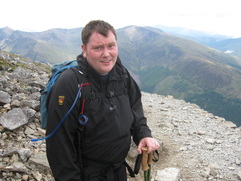
After no less than four false starts, returning back to the room for bits of forgotten kit, and forgetting new bits, we were ready to set off. Dan had the patience of a saint, and I wasn't about to get any less annoying.
After no less than four false starts, returning back to the room for bits of forgotten kit, and forgetting new bits, we were ready to set off. Dan had the patience of a saint, and I wasn't about to get any less annoying.
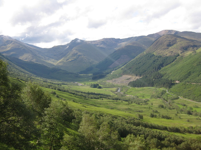
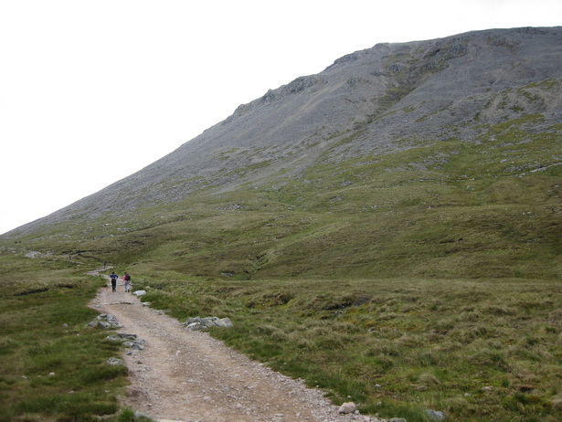
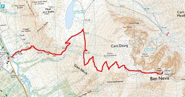
The "SYHA" path started directly opposite the Youth Hostel. We had planned to walk down and pick up the tourist path from the bottom, but as we were already on the SYHA, it seemed rude not to. It was a pretty steep start, similar to when I walked up Kinder Scout over Ringing Roger. I had eaten a Morrisons Pain Au Chocolate for breakfast - more like a chocolate sausage roll, if i'm honest - and it wasn't really powering me up the hillside. I knew I was already in trouble, and it was going to be a first gear grind all day.
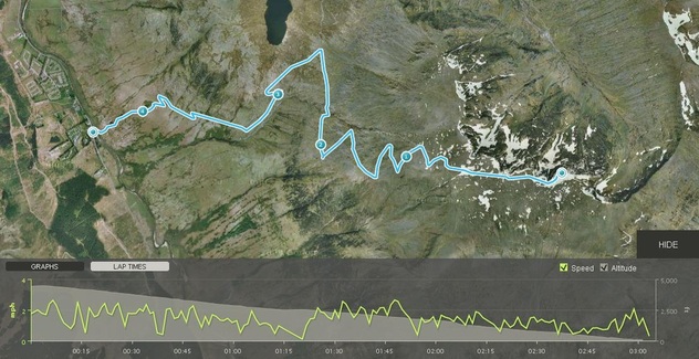
I was using a wrist watch GPS and altimeter to track our progress. I was going hopelessly slowly, but I was going.
The steep start had cost me, and I motivated myself by setting a goal of climbing another 250ft, having a sip of drink and a 30second break, and seeing how I was. I was unchanged at each checkpoint, and I had got that far, so I knew I could do the next 250ft. And so it went on.
The steep start had cost me, and I motivated myself by setting a goal of climbing another 250ft, having a sip of drink and a 30second break, and seeing how I was. I was unchanged at each checkpoint, and I had got that far, so I knew I could do the next 250ft. And so it went on.
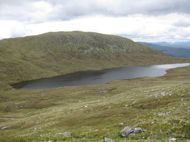
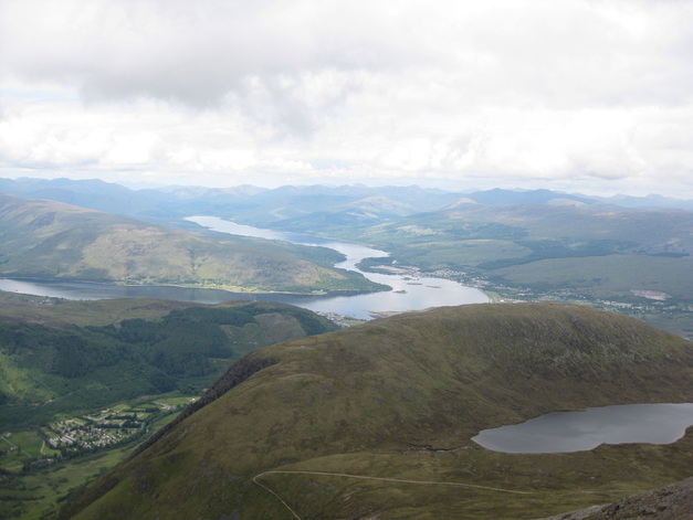
This technique took me to the Halfway Lochan at the shoulder of the mountain, Lochan Meall an t-Suide the col between Carn Dearg and Meall an t-Suide. At 560m, it's a fair way short of being "half way". But it represented progress.
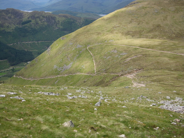
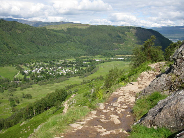
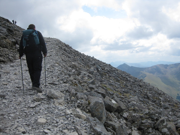
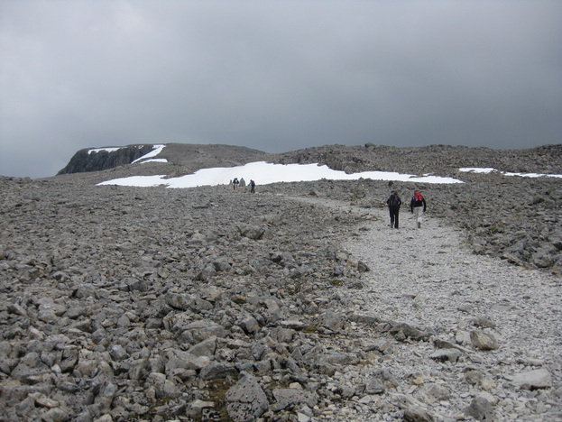
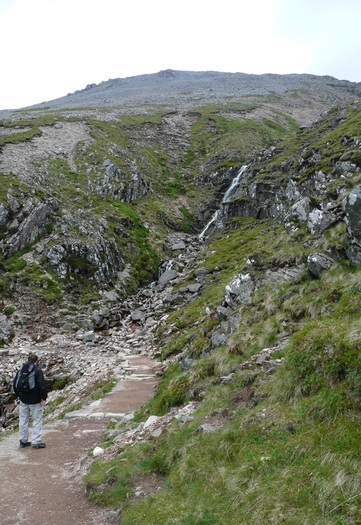
We climbed on, 250ft at a time. The waterfall where the stream crosses the path at around the 2,250ft mark seems to be a turnaround point for a lot of people. After a respite in the gradient of the path coming from the Lochan, you can see the zig-zags up the rocky section ahead. Some people seemed put off by crossing 1" of water. After slogging up to the true half way point, there was no way I was giving up here, and set my next target as the 3000ft mark. Munro height.
If you can do two thirds of something, you can do the whole thing, right?
Right.
Right.
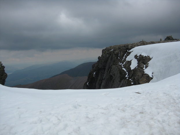
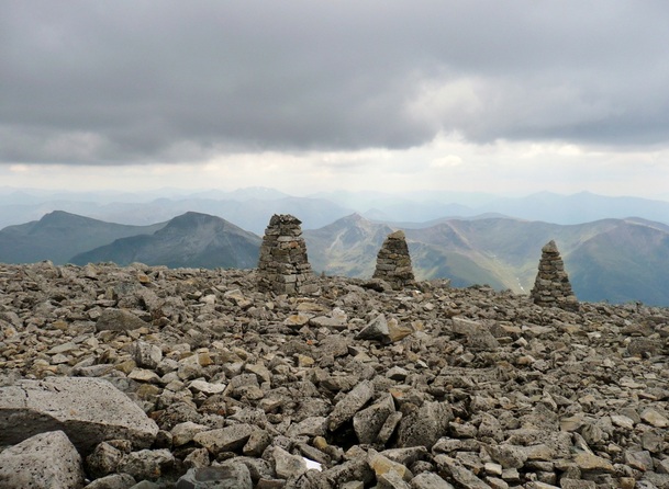
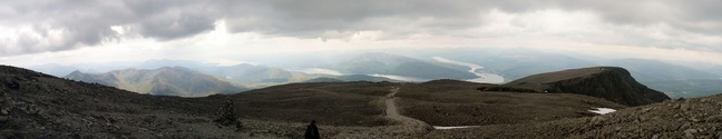
I perked up at the summit plateau. The cairns were marking the "safe" path, which doesn't follow the same route as the made path, but is easily followed as a bearing in white-out conditions.
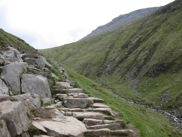
The snow patch was hard. I was exhausted, and it was a lot steeper than it looks above.
It was fairly fresh snow, as well. Every second step I took, I slid back one.
The snow patch was hard. I was exhausted, and it was a lot steeper than it looks above.
It was fairly fresh snow, as well. Every second step I took, I slid back one.
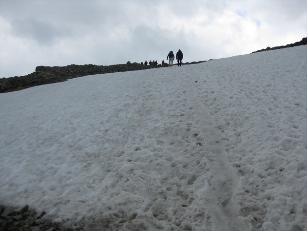
The snow patch really cost me. I could almost touch the summit, but I hadn't the strength to go on.
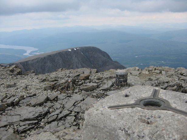
After a serious word with myself, I pushed on up to the trig point.
After a serious word with myself, I pushed on up to the trig point.
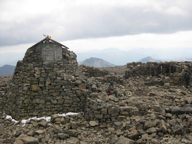
There are ruined buildings on the summit - an old weather station, and some low walls. But no toilets. I'd held out for over 5 hours, and needed to get down off the hill as quickly as possible!
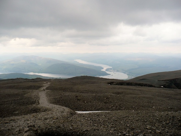
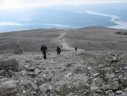
We didn't hang around too long, and set off down the mountain as quickly as we were able.
After another bad night courtesy of a load of French students, who had invaded the Youth Hostel, and were partying in the corridor outside my room, I actually felt OK the next day.
A Full English in Morrisons' cafe, and we hit the road back. The 2011 Caledonian Challenge cycle race delayed things a little through torrential rain in Glencoe, but otherwise it was a fairly smooth trip back.
It took me until the next weekend to properly get over things - i'd lost half a stone and was very dehydrated.
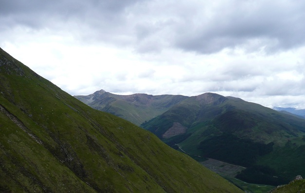
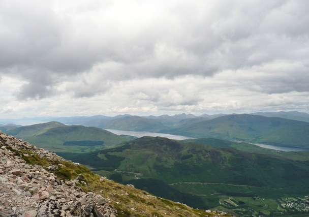
Such a shame the way things panned out. I'd defintiely go back. The Tourist Route gets a hard time, but I really enjoyed it - the scenery was stunning.
Next up... Scafell Pike in September? That would nicely clear off the "National Three Peaks" in 12months.
A Full English in Morrisons' cafe, and we hit the road back. The 2011 Caledonian Challenge cycle race delayed things a little through torrential rain in Glencoe, but otherwise it was a fairly smooth trip back.
It took me until the next weekend to properly get over things - i'd lost half a stone and was very dehydrated.
Such a shame the way things panned out. I'd defintiely go back. The Tourist Route gets a hard time, but I really enjoyed it - the scenery was stunning.
Next up... Scafell Pike in September? That would nicely clear off the "National Three Peaks" in 12months.
 RSS Feed